I had been thinking of travelling to Chile for some years. One day, half in jest, I sent a casual email to Les, my friend in London, asking whether he would like to go there with me. To my surprise, he immediately accepted. After that there was no going back, as I knew that Les was a man of his word. I chose South Patagonia because Torres del Paine and the Fitz Roy area are reputed to be two of the finest wild landscapes anywhere in the world. Now, having been there, I agree. I decided to go in early March, as the ferocious winds abate somewhat, as do the tourists.
Southern Patagonia is shown on this map, with the areas of our two treks marked in red.
I departed feeling a little depressed about the trip due to the prospect of carrying so much weight. The pack was 13 kg, which felt huge on my back. I hoped to make it manageable by storing half the food, the guidebook and a few other bits. I wrote, "Carefree walking in Patagonia it will not be." Arrival in Santiago was hassle-free, except for the $60 US "reciprocity" fee payable by all Australians, which I had not known about. A spruiker picked me up at the airport and managed to convince me that the taxi is only 20% more than the bus. I had forgotten the exchange rate so when he said it would cost 12 pesos I had no idea what this would mean. It sounded suspiciously low. As we drove, it slowly dawned on me that it must be 12,000 pesos ie $18 US. This was not too bad but I wish I had been more savvy.
The Hotel Vegas ($73 US with breakfast for a double) in a stately old building, was easy to find and of quite acceptable quality. Much more importantly, Les was there. Both of us were very pleased to meet the other, as we had had only virtual contact for the last few years. The next day we flew with Sky Airways to Punta Arenas ($138 US one way) and then took the bus to Puerto Natales, arriving at 9.40 pm. We found a hotel, ate a good meal and then, at 11.30 pm discovered we had a problem: no gas for the stove. Having exhausted other possibilities, we turned to our friendly senora at the hotel. Surprisingly, she gave us two bottles - for free. Then a frantic repack, with Les still stuffing stuff into his pack at 1 am and the alarm set for 6. Most concerning of all was that Les' back was in a bad way due to sitting so long in the plane. He is not one to complain, so I knew this could be a serious problem. I gave him a back massage, which helped a little. I wondered how he would manage carrying a heavy pack all day...
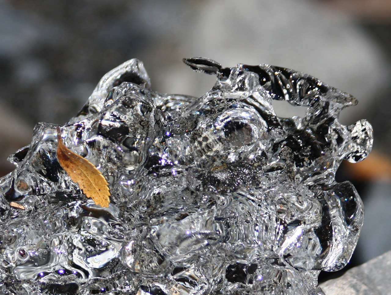
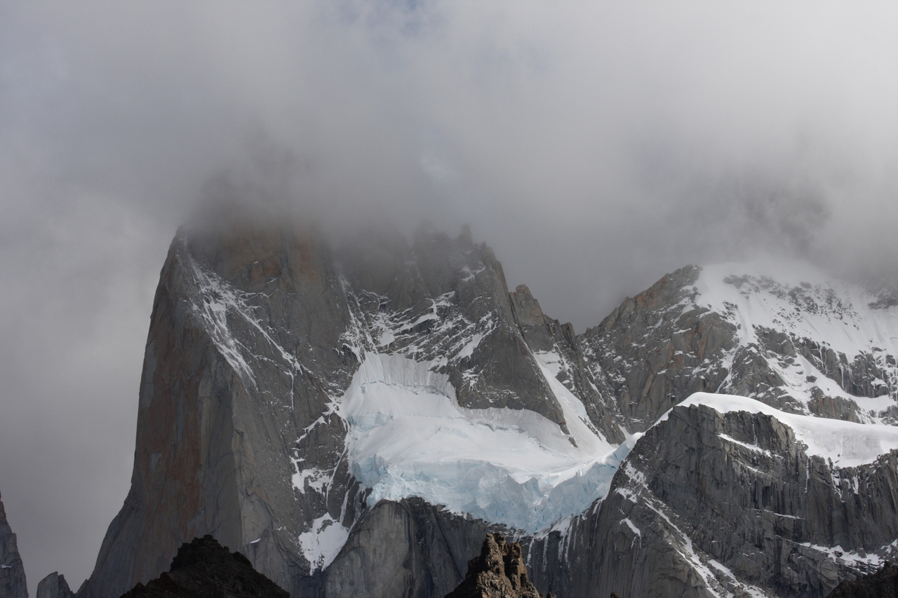
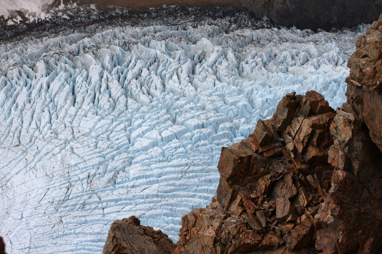
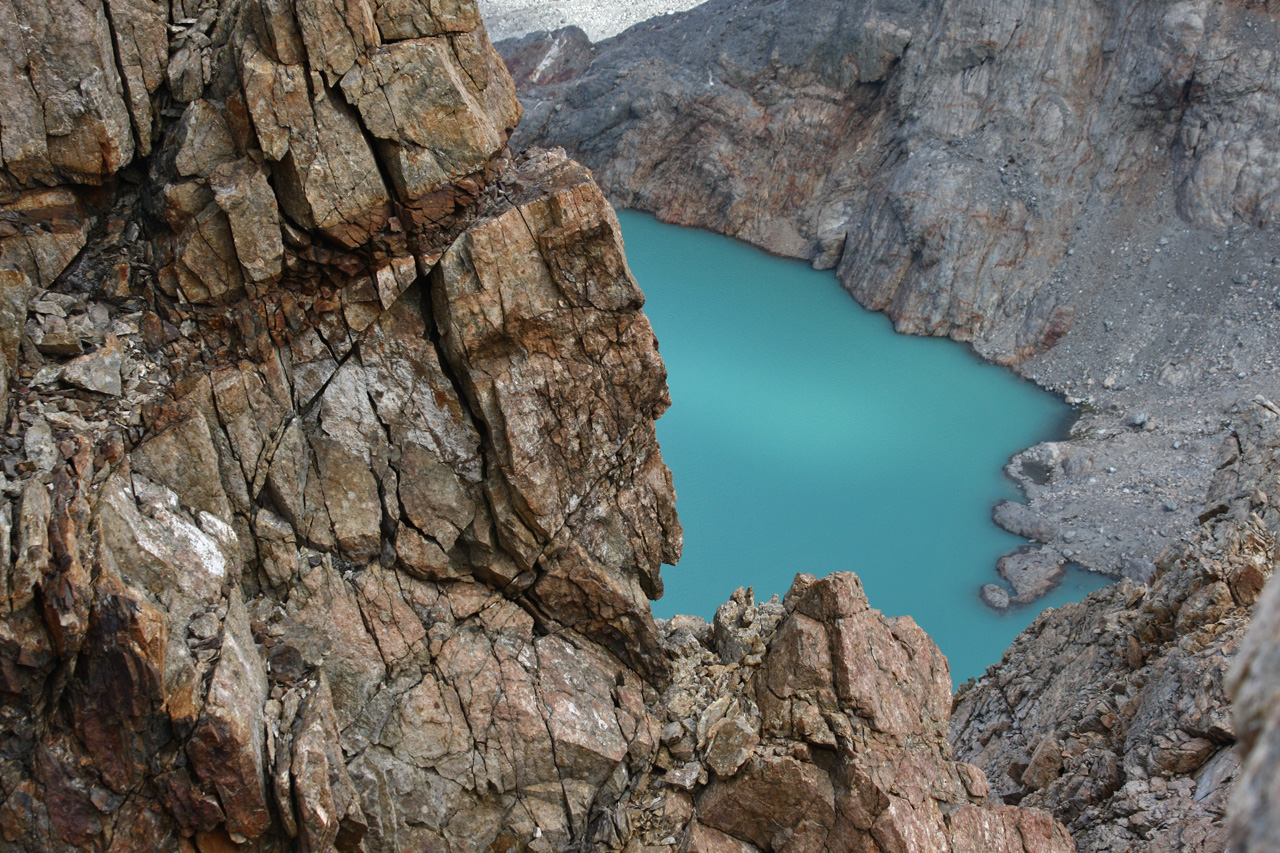
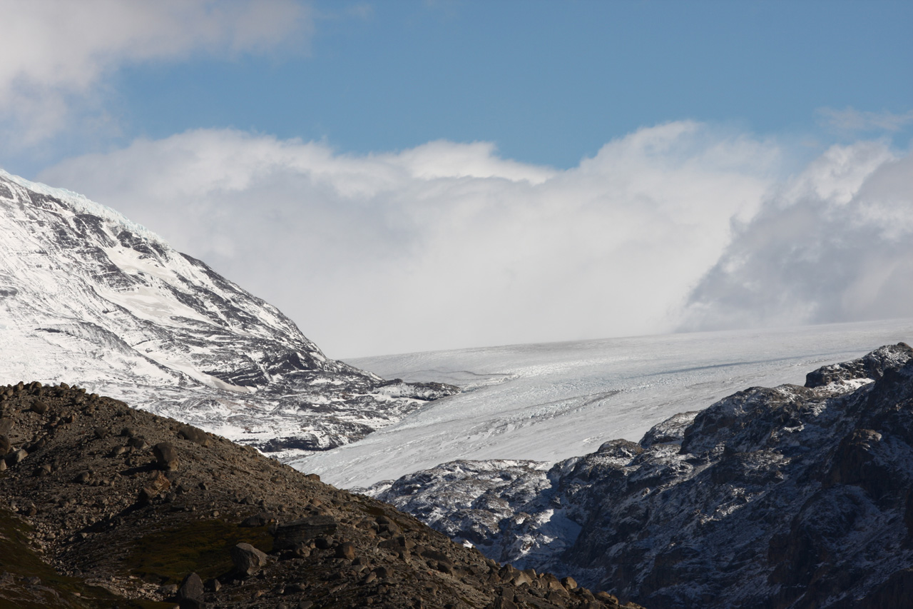
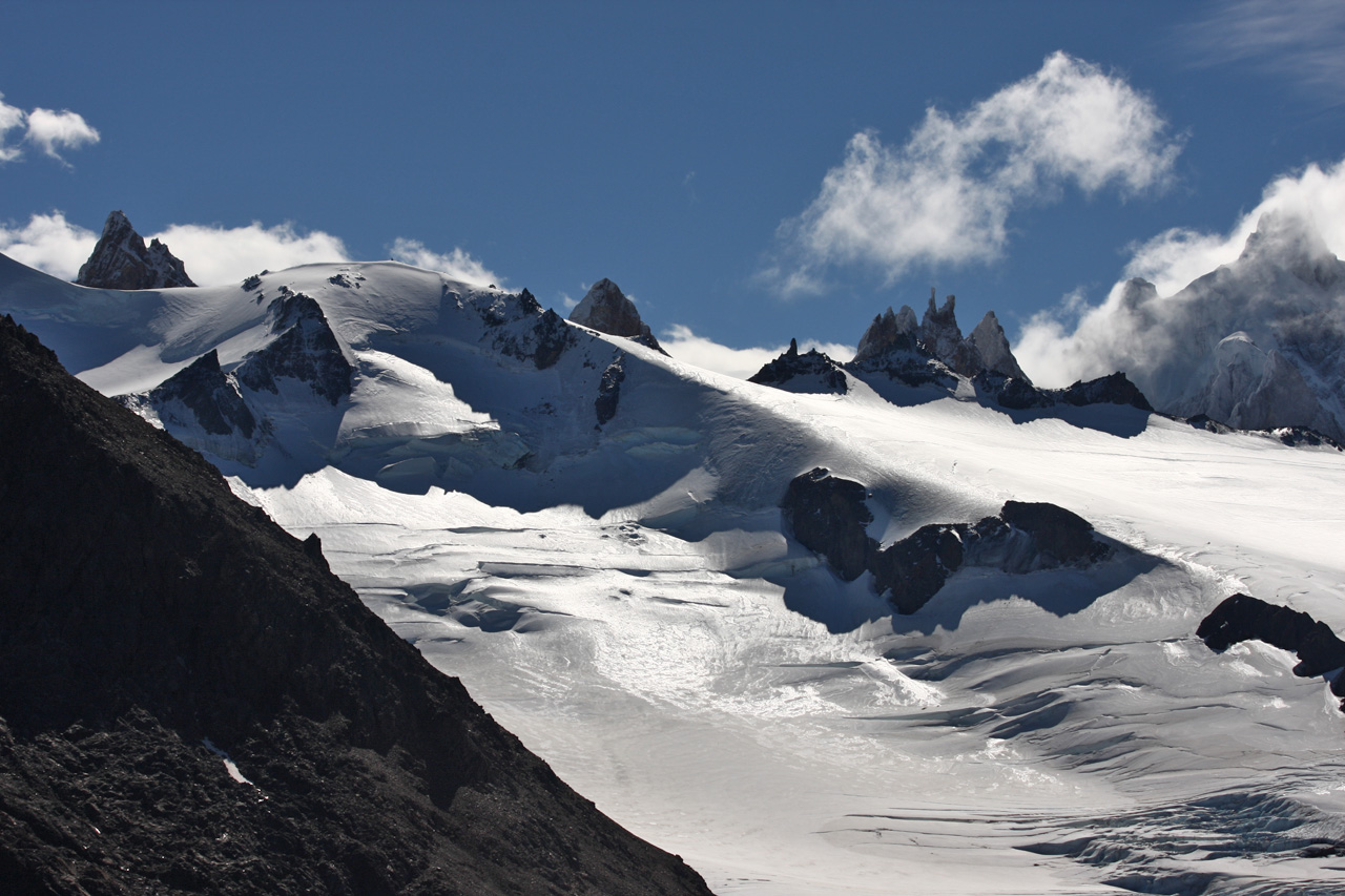
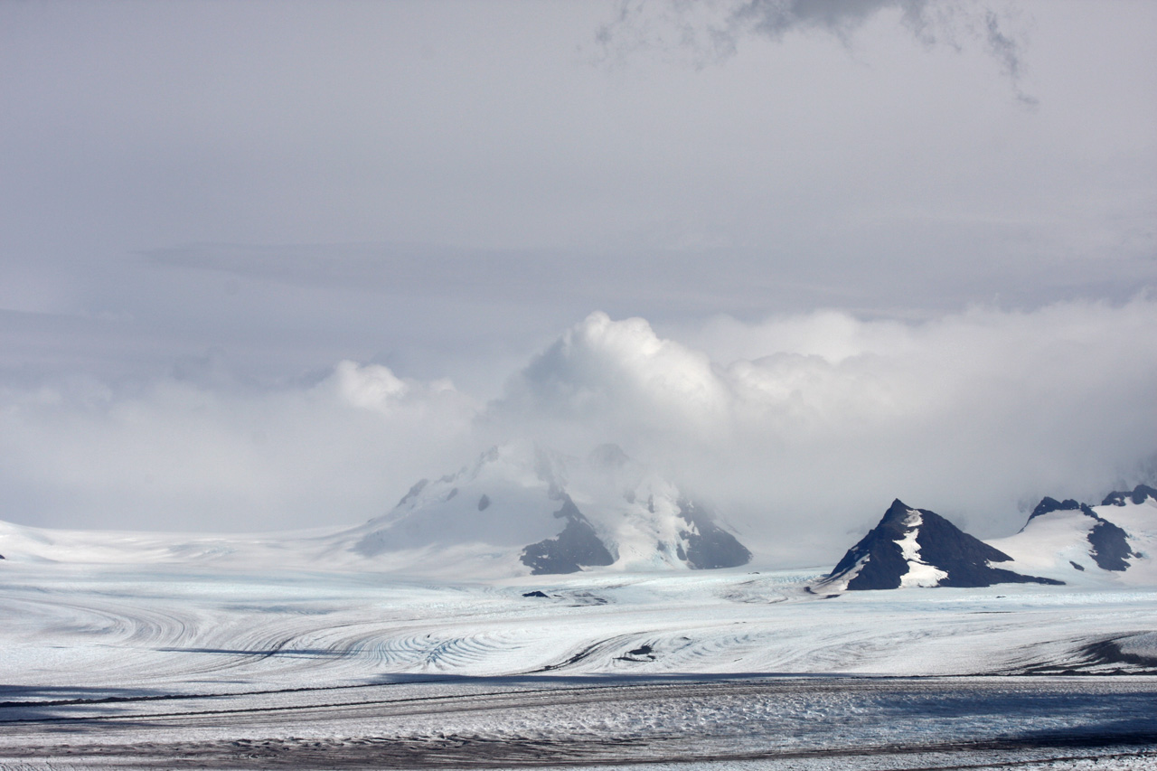
The four shots below were taken from the plane from Santiago to Punta Arenas, passing over our destination, the heavily glaciated landscape of the South Patagonian Andes (click to see images full size).
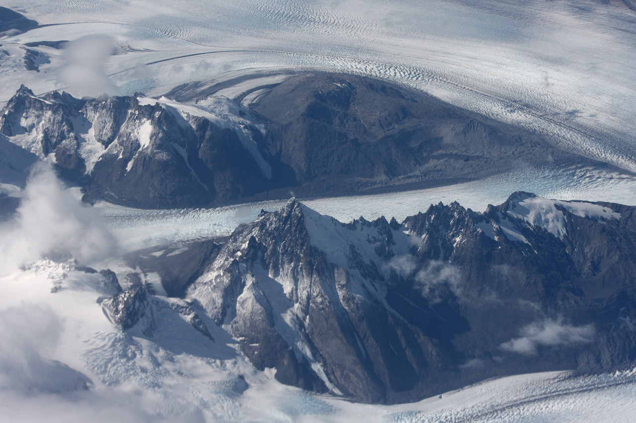
Three glaciers

Not a highway
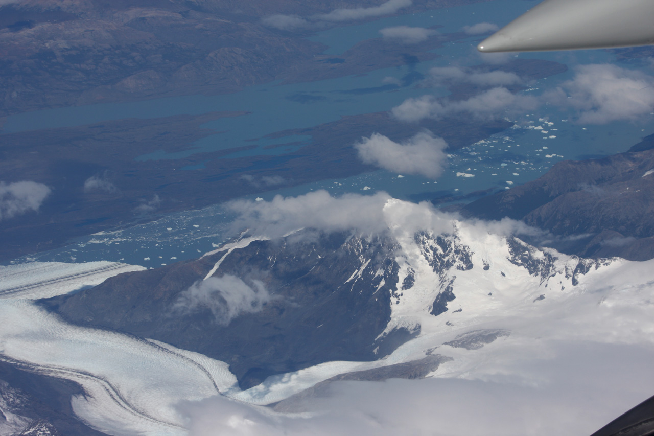
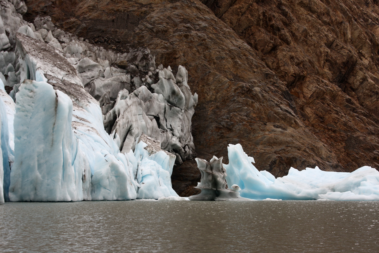
Glacial lake with icebergs
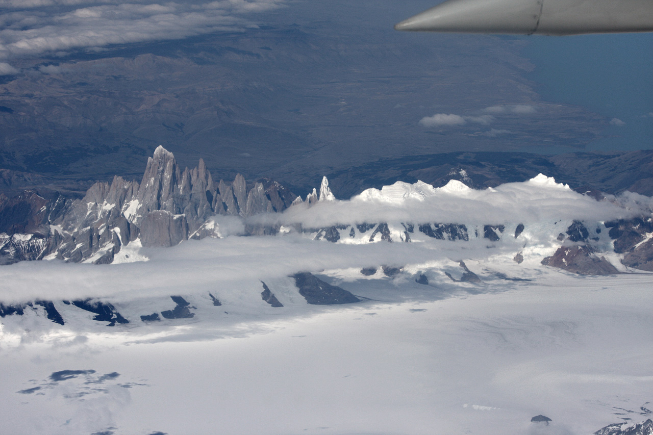
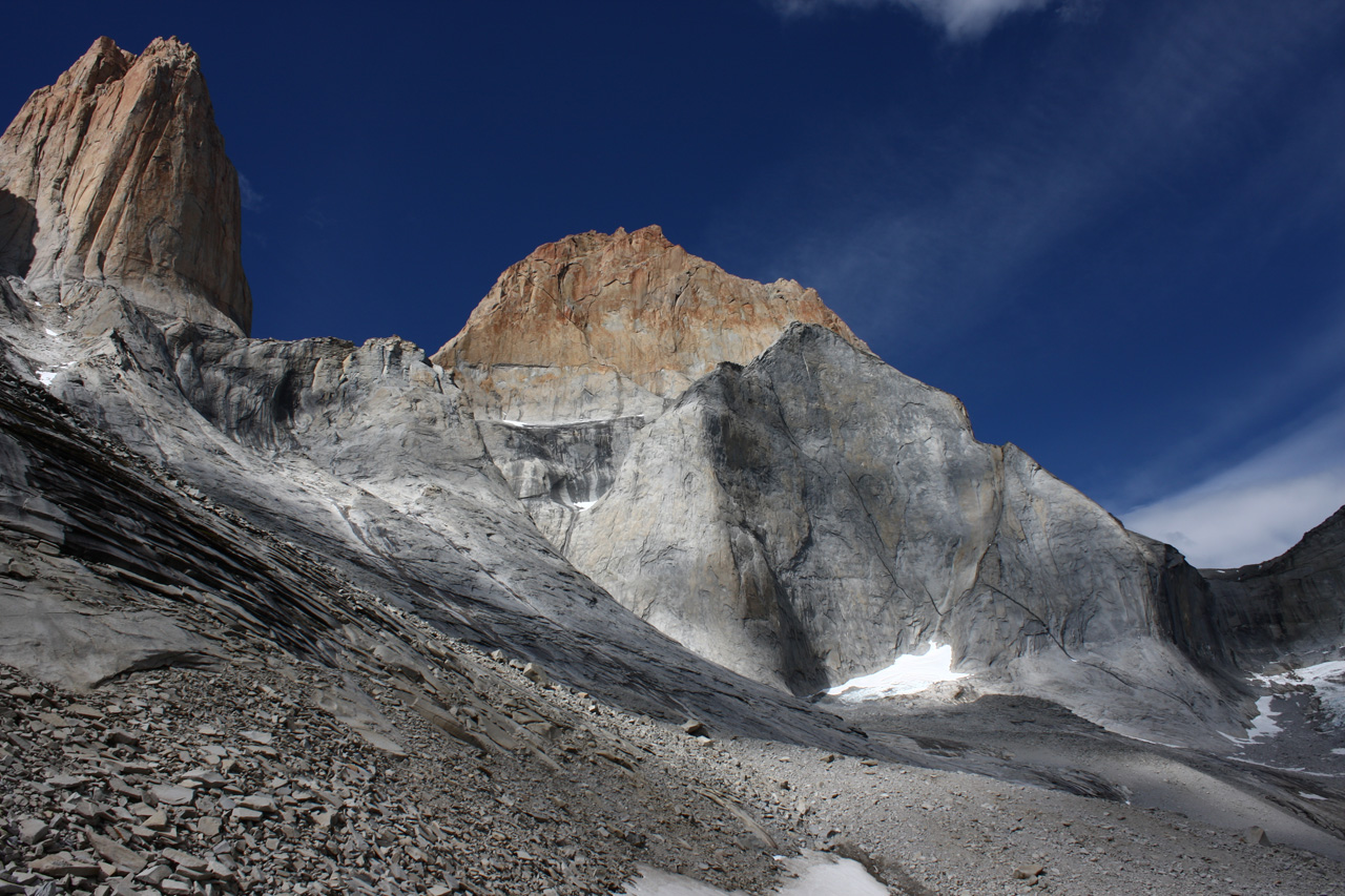
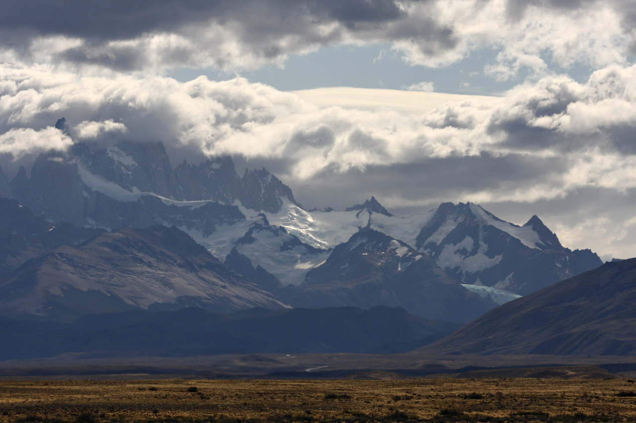
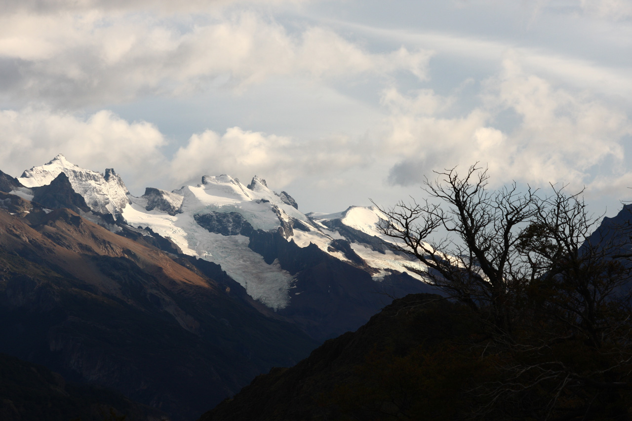
Mt Fitz Roy & the South Patagonian Ice Field (Hielo Sur)
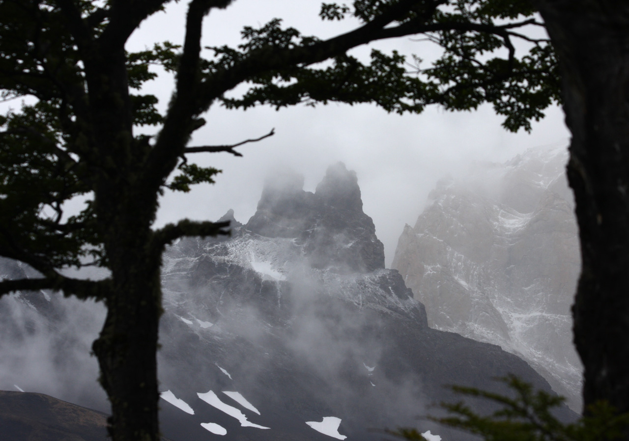
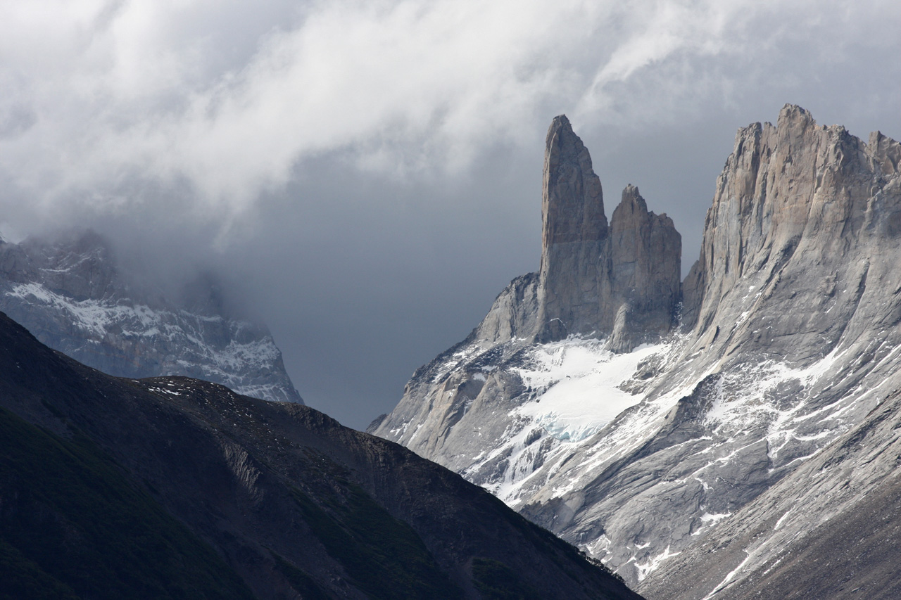
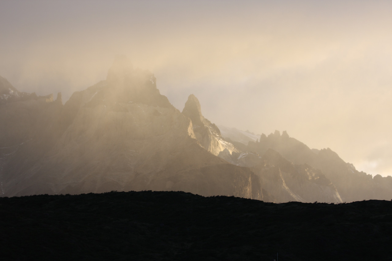
Torres del Paine National Park (Chile)
Day 1The next morning Les' back was better but still not good. Things looked somewhat uncertain and difficult: so many things to think about and small decisions to make, such as what to take and what to leave, where to put things in the pack, whether to book the bus to El Calafate already and whether our (standard) compass is OK. I was looking forward to beginning the walk in order to de-clutter my mind. We had to wait for some time for the bus in the street, where it was about 4 degrees C, entertained by some street doggies who played with each other. The Gomez bus set off at 7.20 and the route soon became scenic, with snow-capped mountains in the distance. At about 10 am we arrived at the Laguna Amarga, where we paid for the park entry and were given a good free map. We officially began the Torres del Paine circuit at 10.40. Carrying the heavy pack did not seem to do Les' back any harm; if anything it kept it straight.
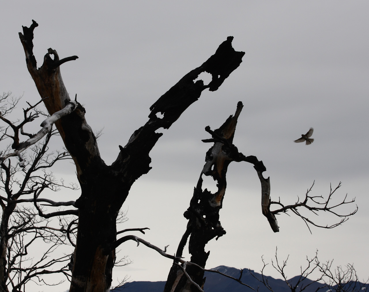
A few other people walked with us initially, but they took the turn-off for the Paine mirador (lookout), leaving us on our own. There were good views of the towers but the foreground was desolate, as it was burnt out and the trees were not growing back. I was carrying about 14 kg (including 2 kg of camera gear) but felt OK. We saw a hare bounding up a hill. At 3.30 we arrived at the Seron campsite, where there was no food to be bought. With my help Les ably erected the brand new tent for the first time. It looked good to me, but Les was not entirely satisfied. The campsite features a communal hut for eating and a caretaker with a friendly Alsatian-type dog. The most salient feature, however, were the clouds of mosquitoes that were seeking our company. We kept applying Rid, which deterred them somewhat.
We went for a short walk to the river and saw two impressive birds: Magellanic Geese and black faced ibis. Then we "cooked" our dehydrated meals. Les gave me some soup, as he made a litre, so I didn't go to bed hungry. We were both cold at night as we kept the main flap open for ventilation. Of course, we kept the netting closed after killing all the mosquitoes that managed to sneak in.

The Paine towers seen fom Lake Amarga
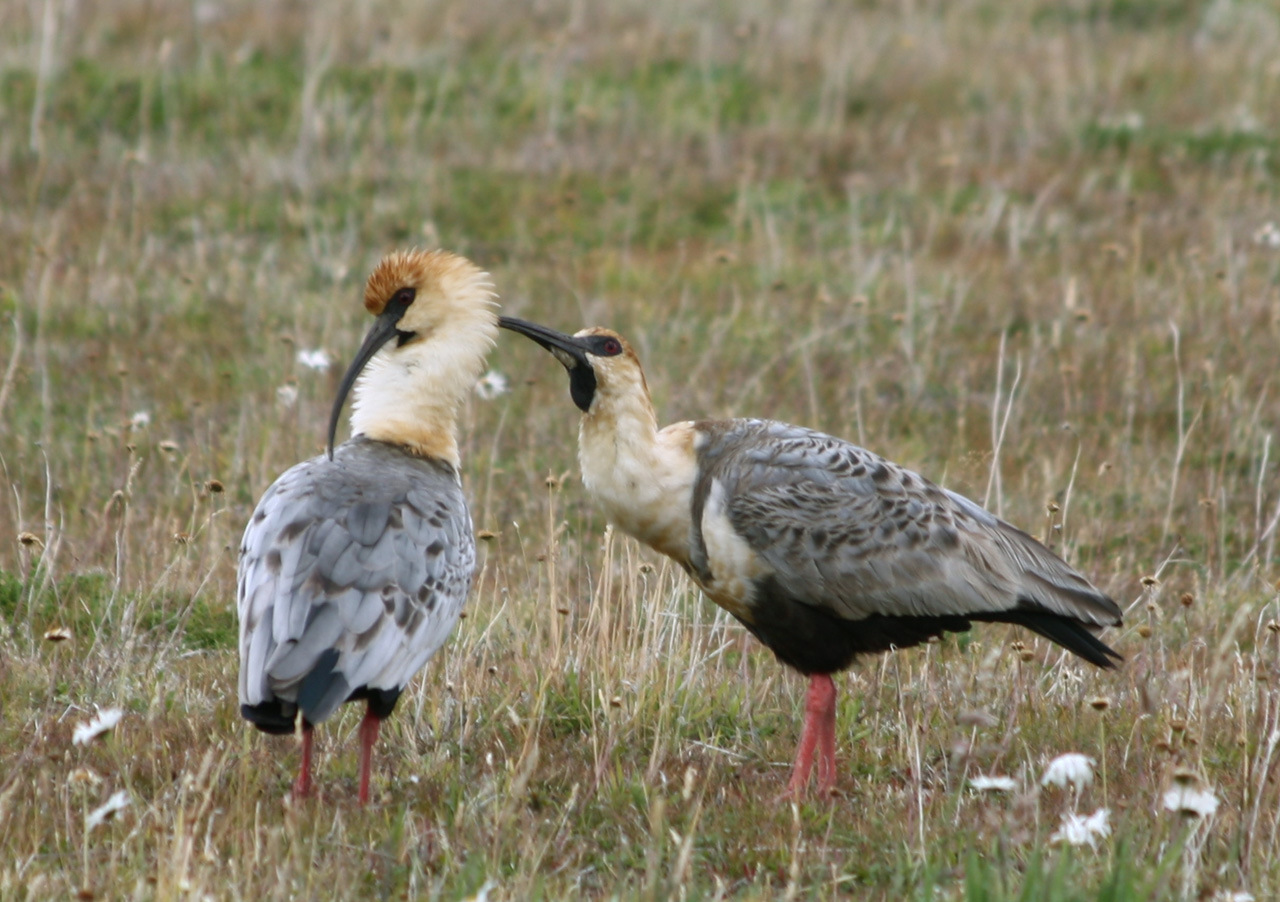
Black faced ibis
We were eager to be off, so we made no tea, just muesli bars and raw oats with cold water for Les. The six-hour walk to Refugio Dickson on the lake of the same name was only moderately scenic and provided our first encounter with Patagonian-style wind. Arriving half an hour too late to score lunch at the refuge, we ate the muesli bars again. Afterwards, it was mainly uphill through forest and then near a glacier, where the light rain turned into horizontal snow, which wet our pants surprisingly quickly. Neither of us had the presence of mind to don our rain pants. We reached the Perros campsite around 7.30, having walked for ten hours with the packs. Pretty tired on arrival. We hurriedly put up the tent in the rain and mud, which was not pleasant. Luckily, we could cook in a makeshift communal shelter, where some people later slept on the floor. I wasn't too happy, watching steam rising from my blue jeans as I stood drying them in front of the stove. Getting diarrhoea didn't help either. I felt cold at night, even though I slept in pants, shirt and jumper.

Day 3
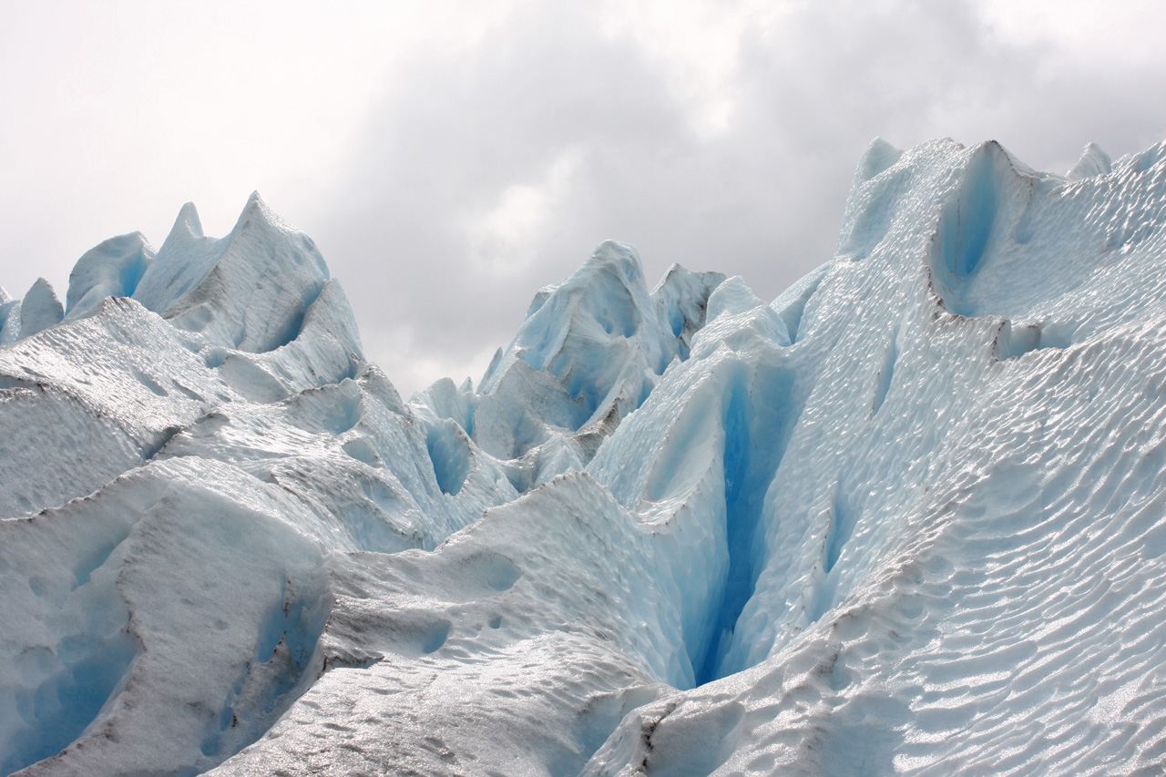
Today was another tough day, as we had a 680 metre climb to the pass. We set off around 9, climbing in mud. This was followed by snow, which thickened as we left the forest. Luckily, there were orange posts guiding us up towards the pass. It began to snow and the wind picked up. I found it tough going up the bare snowfields so Les offered to go first, which made it easier for me, as I could literally follow in his footsteps in the deep snow. Visibility was poor and the wind became fierce, nearly knocking me over once or twice. It was a miserable ascent for me. I was tired, my hands in the wet woollen gloves were completely numb, and I had to hold my hood so that it would not slip off my head. After 3 1/4 hours of heavy labour we were at the John Garner Pass, where there is a motley collection of objects to commemorate peoples' crossings. At 1241 metres, this is the highest point of the Paine circuit. The descent was nearly as bad, with the wind driving directly into our faces. However, my hands revived and we were gifted with the view of the vast Grey Glacier, an impressive expanse of ice stretching out below us.
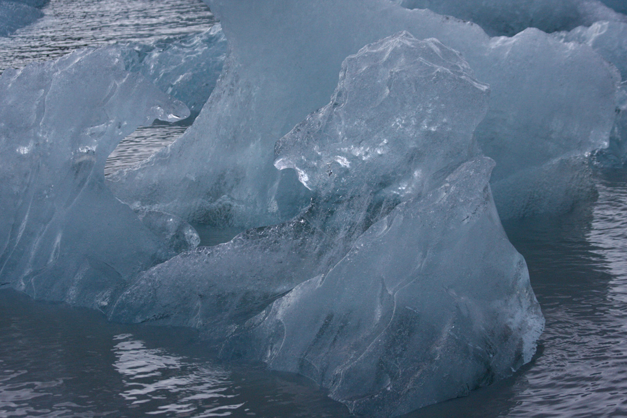
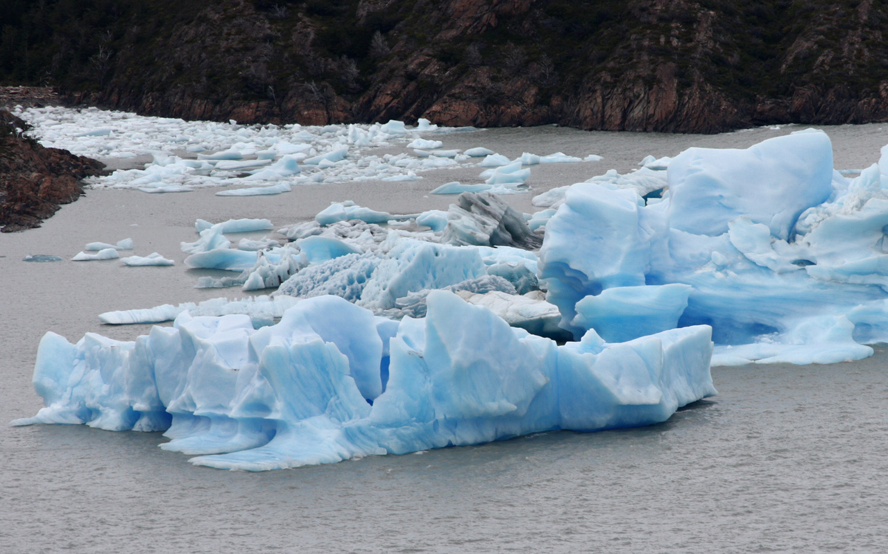
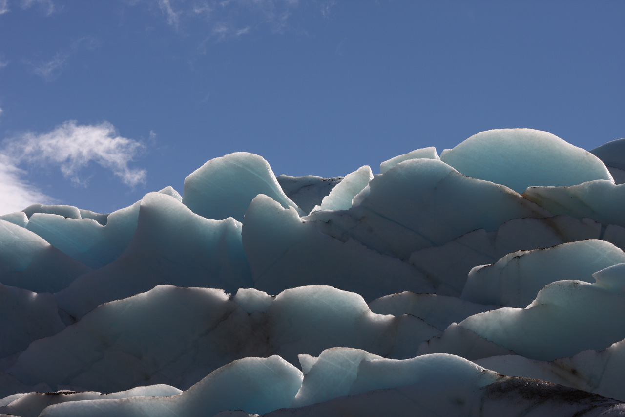
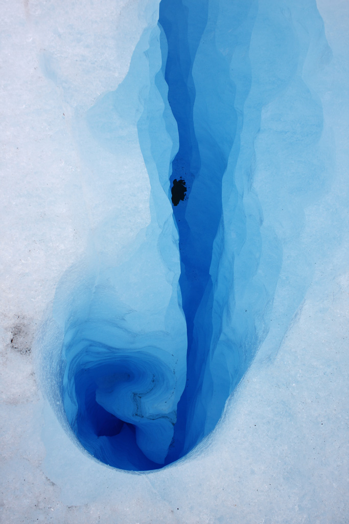
The next part of the descent was through snow-covered forest, then next to the glacier. We spied a row of beached icebergs that had broken off from Glaciar Grey and floated across the lake. The track crossed ravines that were spanned using poorly anchored ladders, which apparently do not remain in place for long. After nearly ten hours of walking since the morning, we arrived at Refugio Grey, a stylish wooden building on the lake. The good news was that we could have dinner, bunk beds and breakfast. We enjoyed eating proper food, after which we had a look at the icebergs floating in the lake and then hurried to the mirador, from which there is a fine view of the blue ice of the glacier rising some 20 metres above the lake. I was fascinated by the icebergs, which came in a wide range of sizes, from pebbles to multi-ton slabs. The small ones looked like sculptures of clear glass. Larger ones were white, while the next size up were pale blue. The largest ones were a saturated pale blue that looked artificial. It's the light passing through the ice that gives it the blue colour. I took quite a few shots in dying light and we barely reached the refuge before it got dark. As this was our second tiring ten-hour day, we scheduled 'relaxation' for the next day, only 19 km.
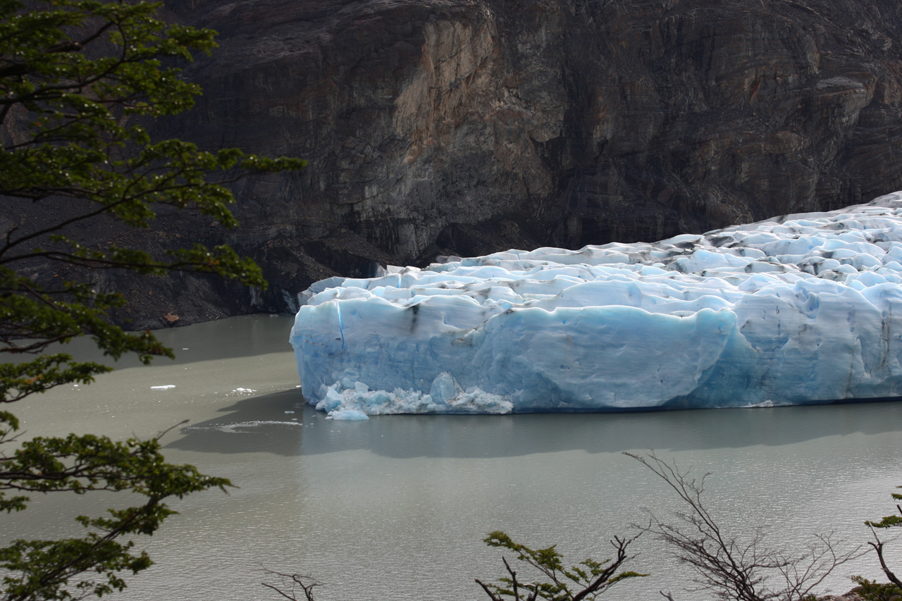
The Grey Glacier - yes it really is this blue

The Grey Glacier
Iceberg or Australian politician?
Small iceberg
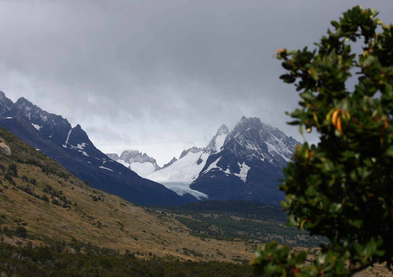
It was great to have a shower in the morning. We left in a relaxed mood at 9.15, photographing blue icebergs in the lake, lichen, waterfalls, the distant mountains and glaciers, both hanging and not. The walk was along three or four different lakes. On arrival, we pitched tent near the Paine Grande Refuge. Then we went on a two-hour outing without packs to the mirador on Lake Pehoe, where there were fine views of the Cuernos (horns). There we met a friendly couple, a German guy and his Spanish girlfriend, whom we would run into three more times.


Lake Pehoe and the Cuernos
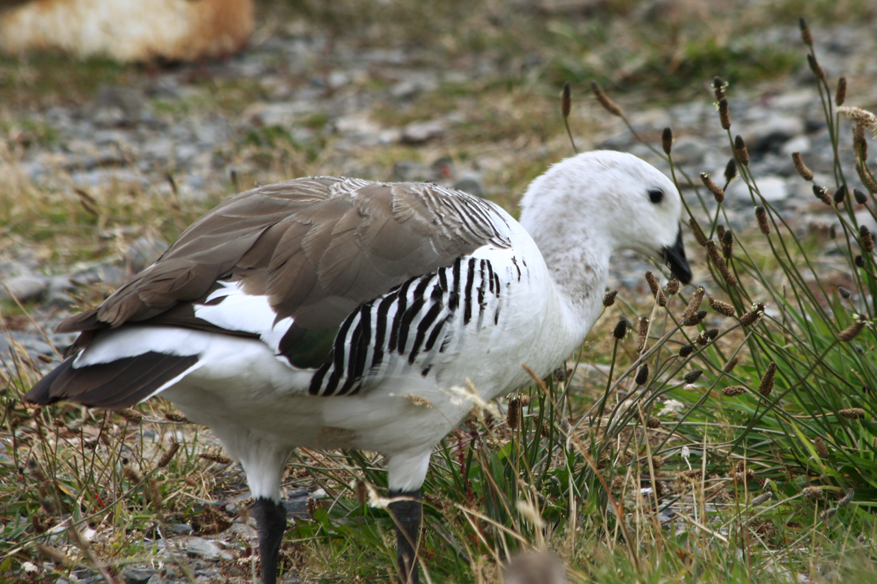
Magellan goose
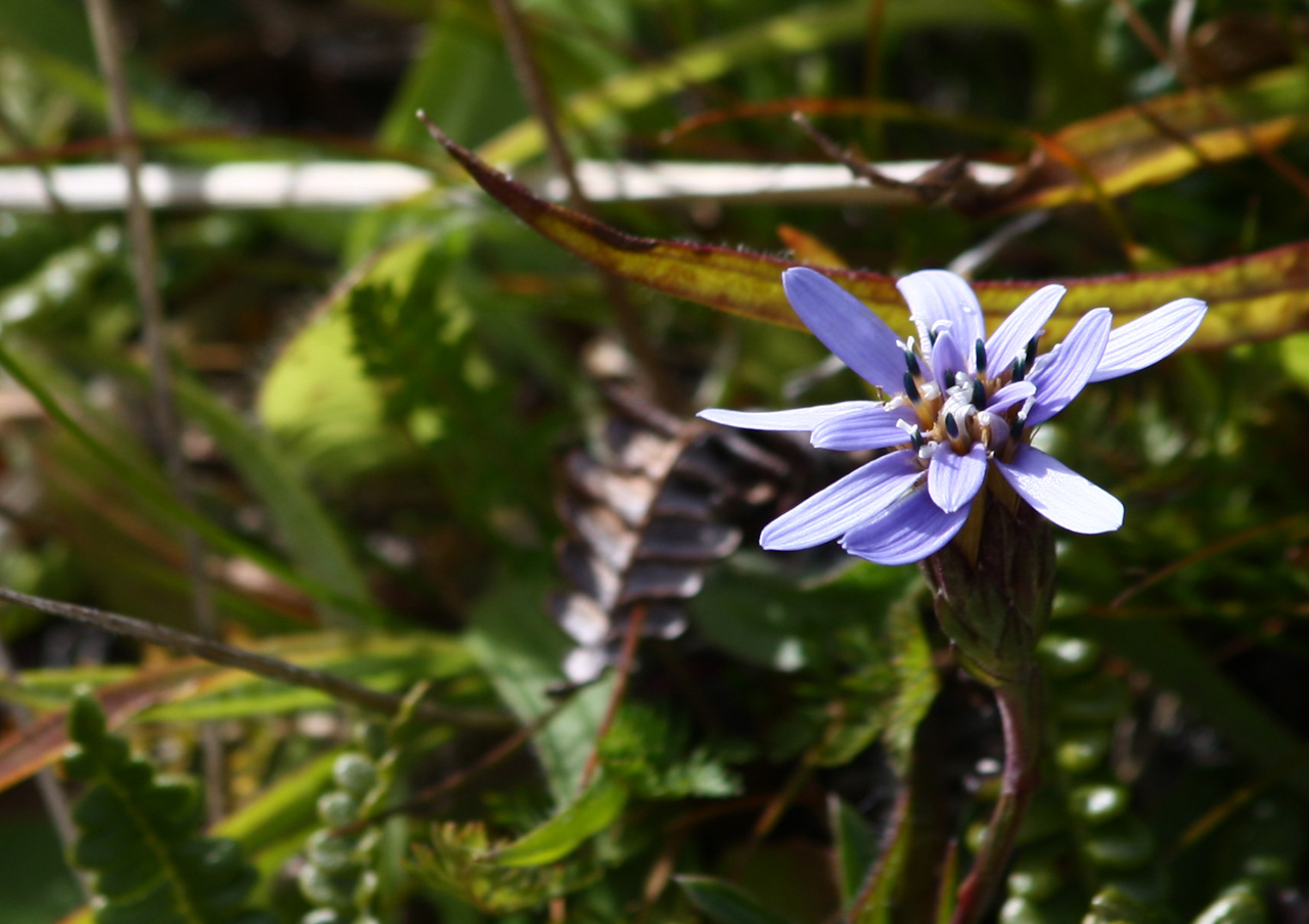
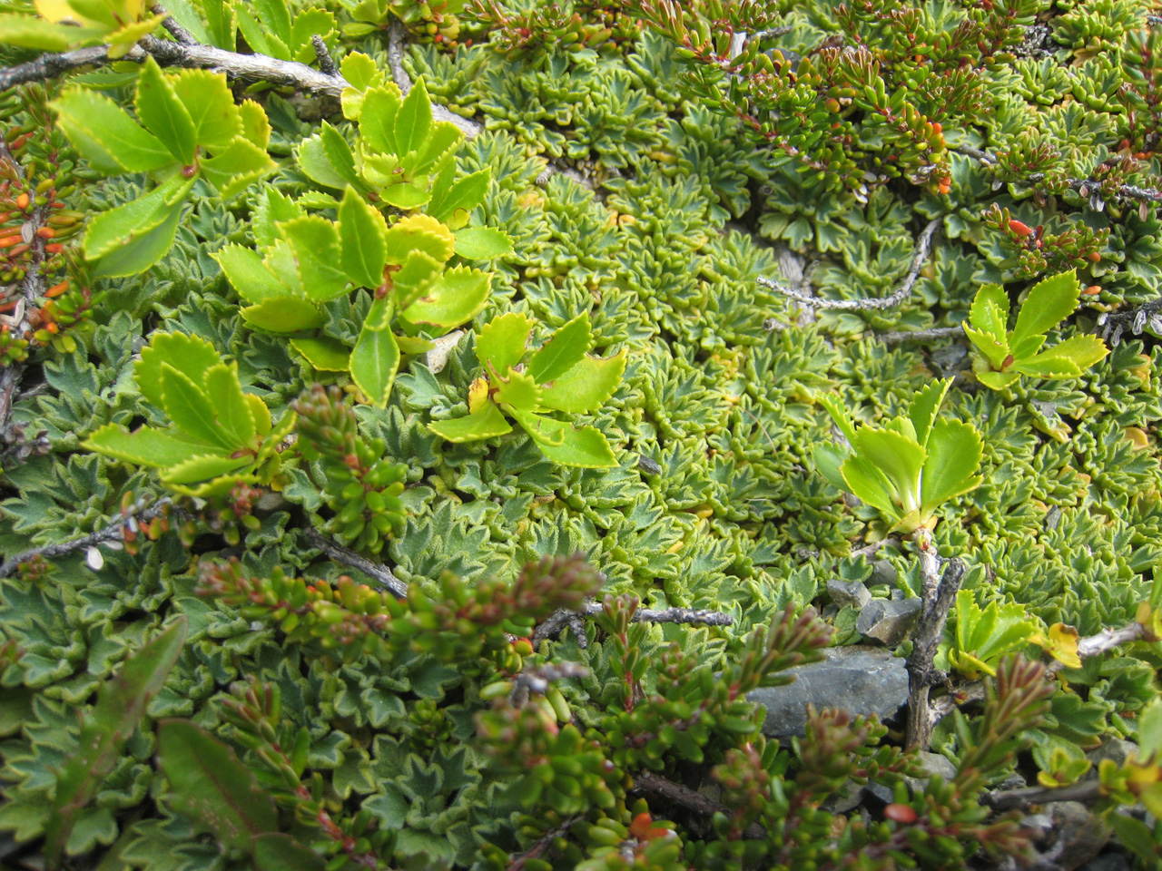
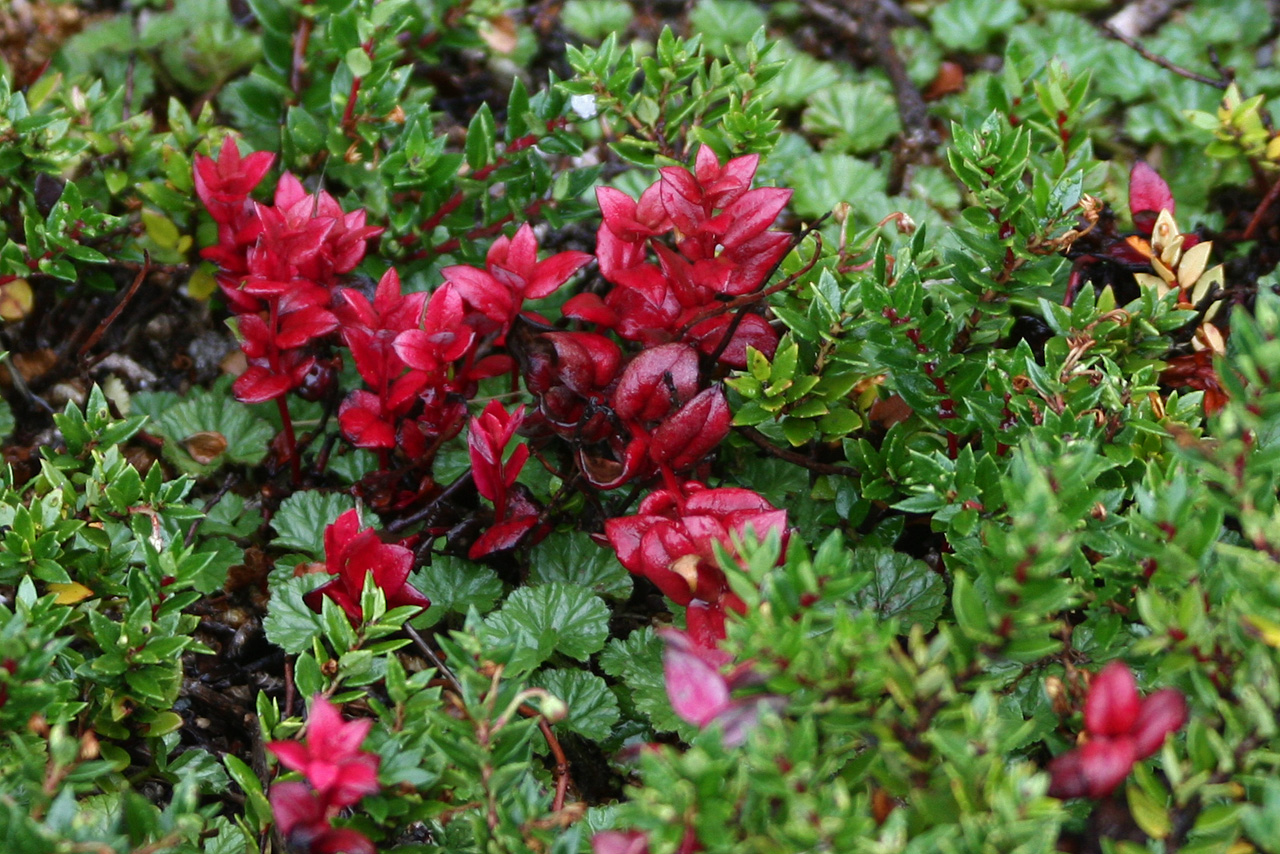
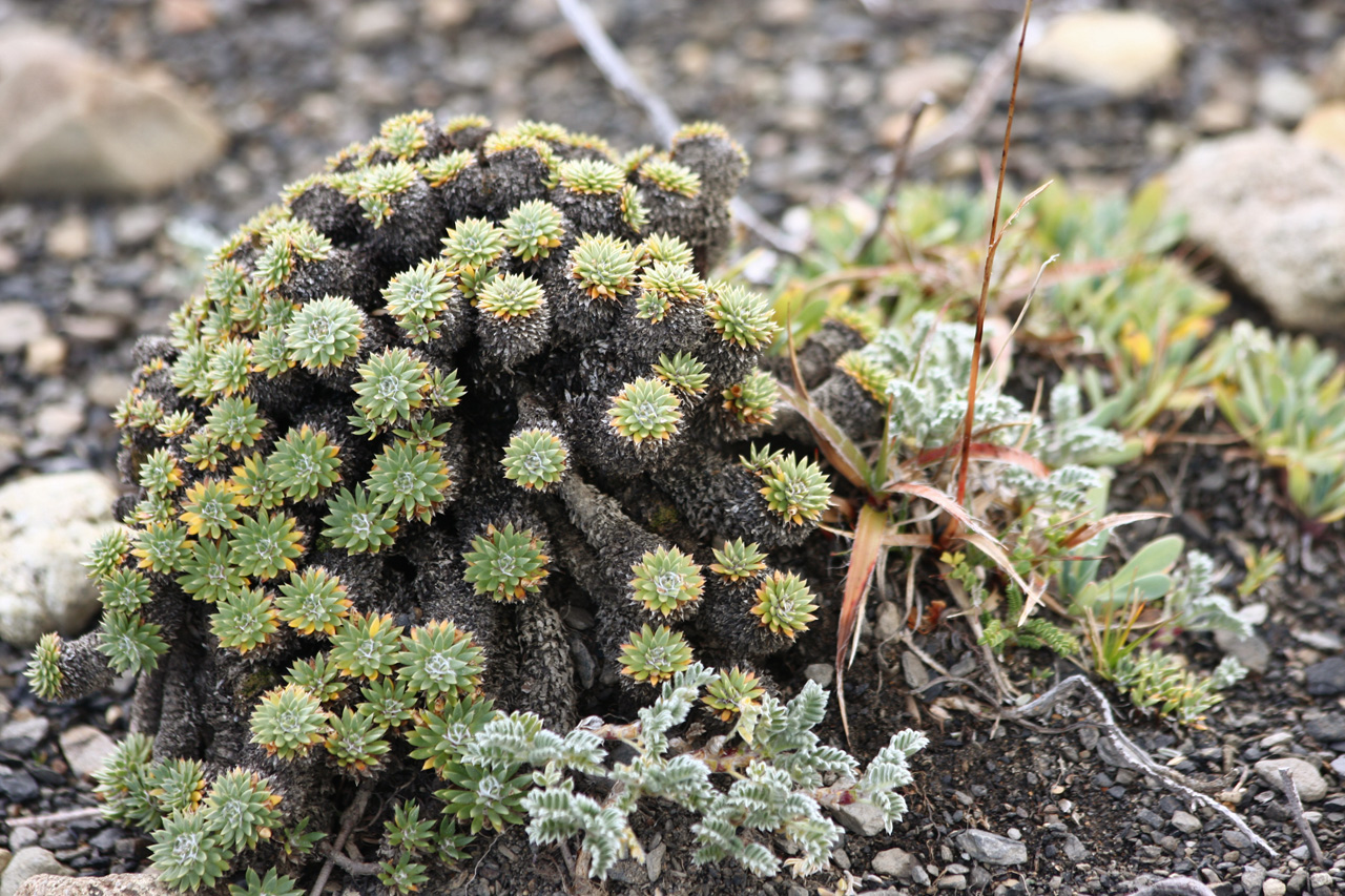
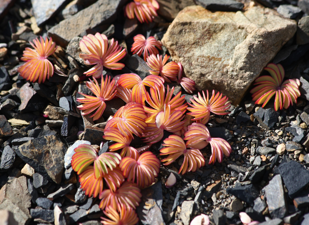
It was raining lightly as we set out in the morning but I had a hunch it would clear up, which it did. I felt like a new man, as my diarrhoea had cleared up. Knowing that it would be a long day, I set a fast pace on the way to the Valle Frances. This valley cuts into the massif and is one of the two main side-trips of the Paine circuit. We dumped nearly all our luggage at the Campamento Italiano and headed up the valley towards the Campamento Britanico. Soon we were treated to an impressive cirque of glaciers. Then the path led up the moraine and into another valley. Presently, we were granted tantalising and then full-on views of the Cuernos del Paine. We lunched on muesli at the Britanico, after which my stomach and bowels resumed their unhappy song. We pressed on to the mirador, which was close by. Seeing we still had time, we decided to continue along the path, which ascended fairly steeply by a small stream. I would have happily spent an hour photographing the diminutive cushion plants and flowers growing there, plus other intriguing minutiae, but time was limited. Unlike almost everyone else I have walked with, Les does not discourage my frequent photographic stops. He even encourages me to take more photos, which is amazing.
The path became indistinct after we reached a higher shelf. It may have been a trick of distance but we seemed to be just below the bases of the Cuernos. Now a pass on the horizon beckoned to us. Les set off at a cracking pace upwards on the boulder scree. Feeling a bit off, I lagged increasingly far behind. After some time, Les beckoned me to go back as he thought we were running out of time. So we will never know what view there was from the pass, assuming it was a pass. We quickly descended to the mirador, down to the Britanico and then back to the Italiano. Here we munched a few macadamias before resuming our burdens for the two-hour walk to the Refugio Cuernos. I was keen to go fast in the hope of arriving early enough to secure a cooked meal, rather than eating our dehydrated mush. Les told me to slow down. I couldn't enjoy this part of the walk, even though it was scenic, next to the lake and on two pebble beaches. We arrived early for dinner, which turned out to be inferior to our rations. Les went out to dry the tent while I just sat on a stool, trying to recover. I bought 4 litres of pineapple juice and drank more than half of it. It had been a 9 1/2 hour walking day, much of it uphill, and I was exhausted. Les too reported feeling tired, but he may have said this to cheer me up. The refuge was quite a cheerful place, with lots of young people milling about.
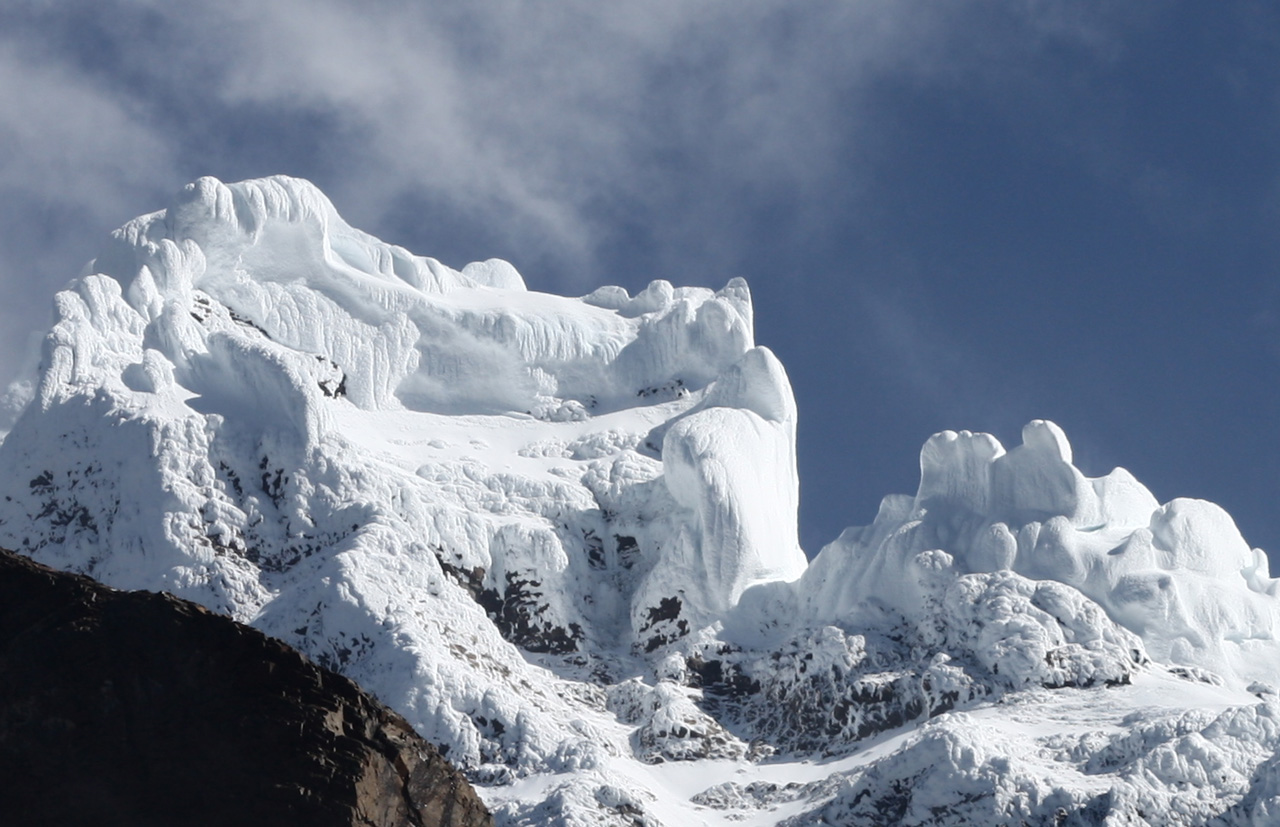
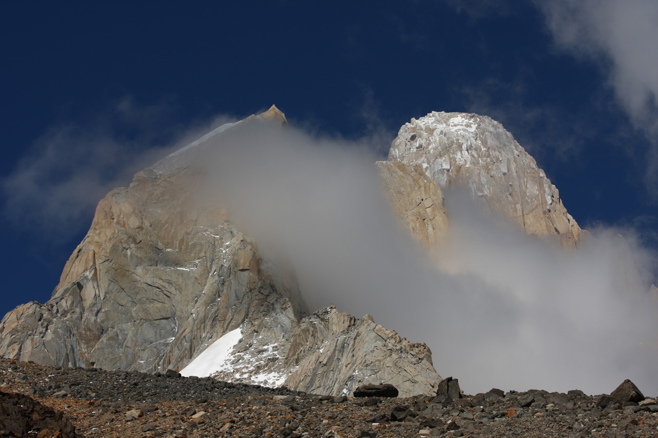
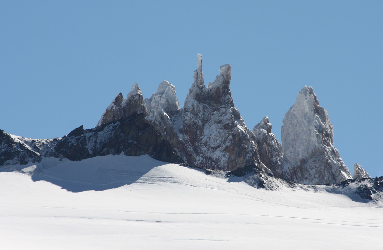
Ice mushrooms on summit of Cerro Torre

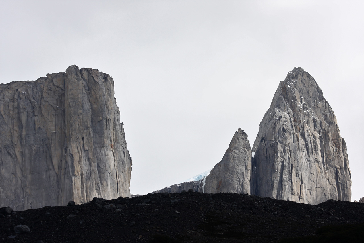
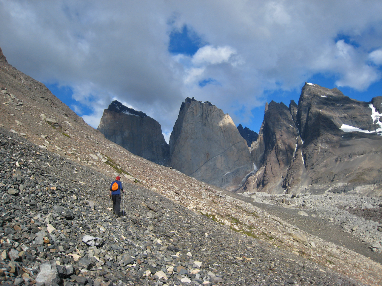
The track led us along the lake until we took the turn-off towards the principal mirador, which is in the second main valley that cuts into the Paine massif. We were both hot as we climbed, running on empty water bottles, as it was steep and the sun strong. We lunched next to the Chileno Refuge and resumed our progress up the valley. Les spotted two condors hovering above us. As this was the most frequented part of the entire circuit - even people who spend only one day in the park walk here - the vultures were in the right place. Soon we were at the Campamento Torres, where Les selected a lucky spot (#13) with water frontage. Then we hiked for an hour on a well-marked but steepish trail to the principal mirador of the park. I was feeling quite weak so I told Les to go on ahead.
The view of the Torres, rising up above a glacier and its green meltwater lake was wonderful. I later learnt that two of the adjacent towers, which looked to be just next to each other, were actually two kilometres apart, so it was difficult to judge the scale. We did the touristy thing of self-exposing ourselves in front of the towers. Suddenly, I noticed that my small camera case was empty. Near panic. 'Near' because I knew I must have left it on a rock and there was no-one around to take it. Searching the rocks did not help. Then I recalled I had put it in my jacket pocket. Back at camp, I spoke to a Slovakian girl called Maria. She was walking the 'W' (the best parts of the Paine) alone. She had stayed for four weeks at a wildlife refuge in Bolivia, where her job was to take a puma for its daily walk. It liked to stalk her.

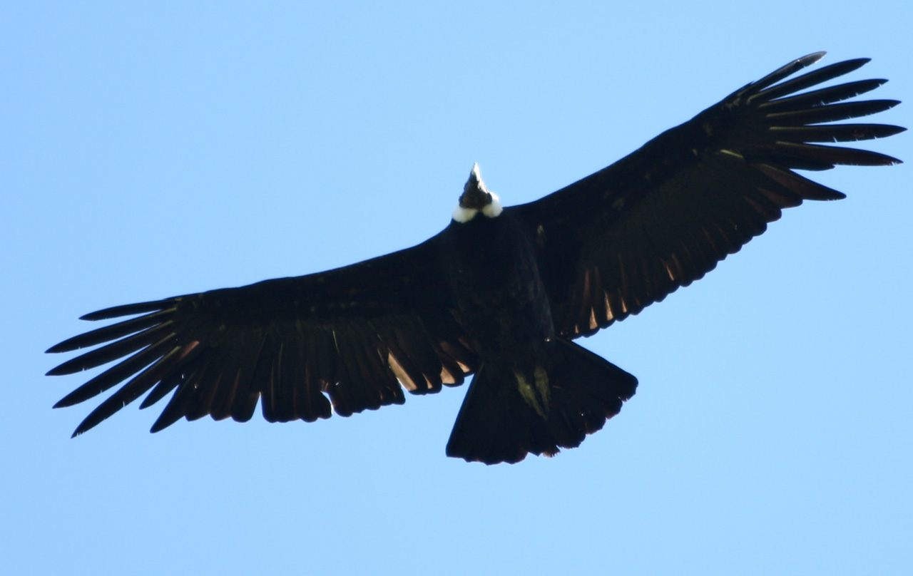
Condor
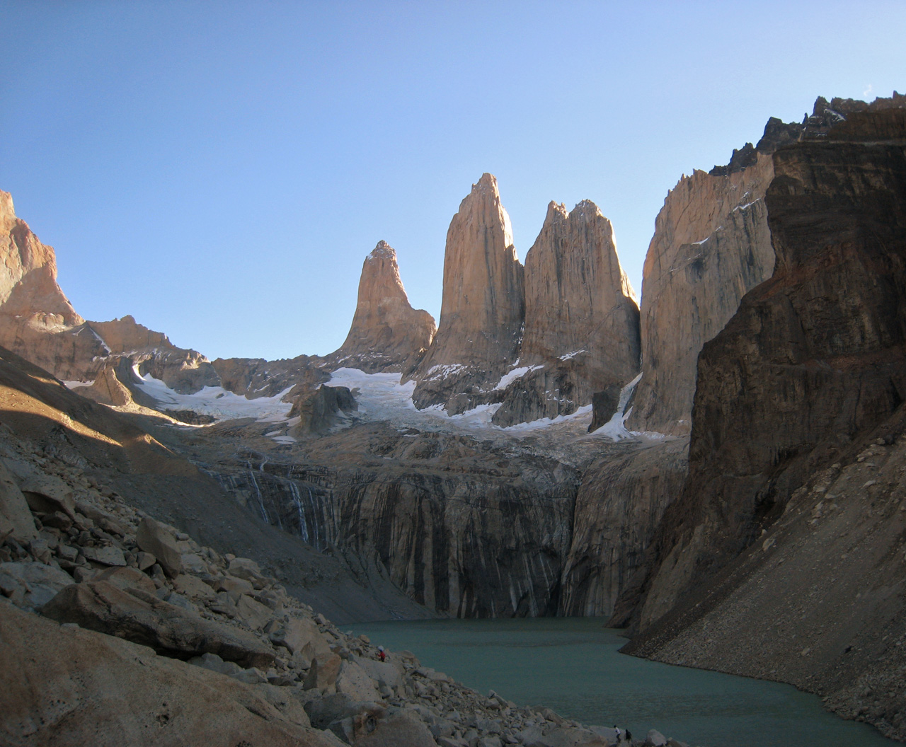
Mirador of the Torres

We saw from below the spectacular colours of the sunrise on the towers. It seems that the park authorities discourage people from going into the evocatively named Valle del Silencio, a side-trip deeper into the massif. For this reason, Victor, a well-spoken Spanish man, asked whether he could join us on this excursion. We did not see another person on the entire walk. The three of us left at 9 and reached the Campamento Japones an hour further up the Ascensio Valley. It was deserted, with just a primitive shed and two good sculptures, one of birds made by a Korean artist. A little further on in the forest, we turned left up into the Silencio Valley. Then there was a large clearing strewn with boulders. Victor told us we could safely eat any berries that grow in Patagonia and we took his advice, trying the small red ones (a bit like cranberries) and the large pink ones, which taste like apples. Soon we were on an indistinct path that traversed a long distance across a barren mountainside, just above the tree line. Then we crossed onto the glacial moraine. The path became very vague, though it was still marked with occasional cairns. I did a lot of hopping on the granite boulders. I went on some way ahead, with Les behind and Victor trailing. Victor turned back near the end of the moraine, as he still wanted to reach town that evening. He agreed with Les that he would place a stick in the mouth of the wooden mask at Japones to indicate he had made it back safely. Les and I continued on past a granite shelter made by mountaineers, who had presumably hoped to wait out the weather. We reached the end of the moraine, where the valley was closed by a chain of peaks, with the Torres on one side. We decided to make a rock above us on the scree our terminal point. I made the mistake of walking up the other side of a small stream which was covered with hard snow, so that when I levelled with Les I had to cross about fifteen metres of snow. I dug my boots in to ensure I did not slip, as this could have caused a long slide. We ate our bars and admired the views. Behind us rose the famous Torres, now seen from the opposite side to that from the other mirador. On the other side of us was an arc of striking mountains, with small glaciers hanging at their bases. Every now and then a loud but small avalanche of snow would fall onto the rock-covered main glacier below us. Having this private audience with the mountain gods in full sunshine was a real gift. For me it was the highlight of the Paine tour.
After lunch we picked our way down the scree, got back onto the moraine and sporadically followed the vague path, often losing it among the boulders. Both for fun and in order to make faster progress, we crossed three fields of permanent snow. We continued for about two hours on the difficult terrain that required hopping from boulder to boulder. The wind now gusted down the slope with Patagonian fierceness. At times it would have knocked me over if I had not caught hold of some rocks. Presently, we realised that we were lost - no sign of a cairn or path. Les thought we should continue descending on the moraine but I was sure we had stayed on it too long already. We got up onto the hillside but there was no trail there either. So we returned to the moraine and continued down it, but we soon saw that it finished, with the beech forest stretching below. As a last resort we could have followed the stream bed as far as the Ascensio Valley, but that could have taken hours. Les now agreed to make our way above the band of low trees to look for the traversing path that had taken us to the moraine on the way up. I suggested that we push our way through the thicket where the band of trees was narrowest. After just two metres I realised this was a mistake - we'd need machetes. So we retraced our steps up the moraine until we reached a place where it was possible to walk between the trees. We even found fresh footprints here - possibly Victor's. About a metre past the trees, Les found the path and the rest of the descent was straightforward. We stopped for more berries to imbibe some vitamins. At the Japones we saw the twig, indicating that Victor had made it safely.
Back at the Campamento Torres, we had a five minute rest, put on our loads again and set off for the Chileno refuge. I was tired and my feet were sore from four hours of boulder-hopping, but I maintained a reasonable pace, ending a 10 1/2 hour day at the refuge. The dinner looked inviting, but sadly they could not feed us. I had stupidly omitted to make a booking when we had passed through on the day before. We sat at a windy table outside the lodge, cooking our meal, with the more fortunate diners looking on amusedly. I had my best dehydrated meal, chicken tikka, and we briefly saw condors again as it was darkening.

Sunrise

9 minutes later
Victor in the Valle del Silencio
At breakfast we spoke to our familiar German-Spanish couple and then gently paddled (sore feet) down to the Hosteria Torres, where there are a few hotels and a hearty lunch was possible. It was sunny, warm, relaxed, and time to write home. The shuttle bus took us to Laguna Amarga, whence we sped to Puerto Natales. Les was highly amused with our difficulty in recovering our left luggage from our previous hotel. We had neglected to register and it took the senora some minutes to identify us as being an entry in the register marked simply as "gringos". I made a maximal mess of our room during a major repack for the Los Glaciares excursion. We went to bed after midnight and set the alarm for 5.45 in order to make a dash for the frontier, about which I had considerable trepidation.
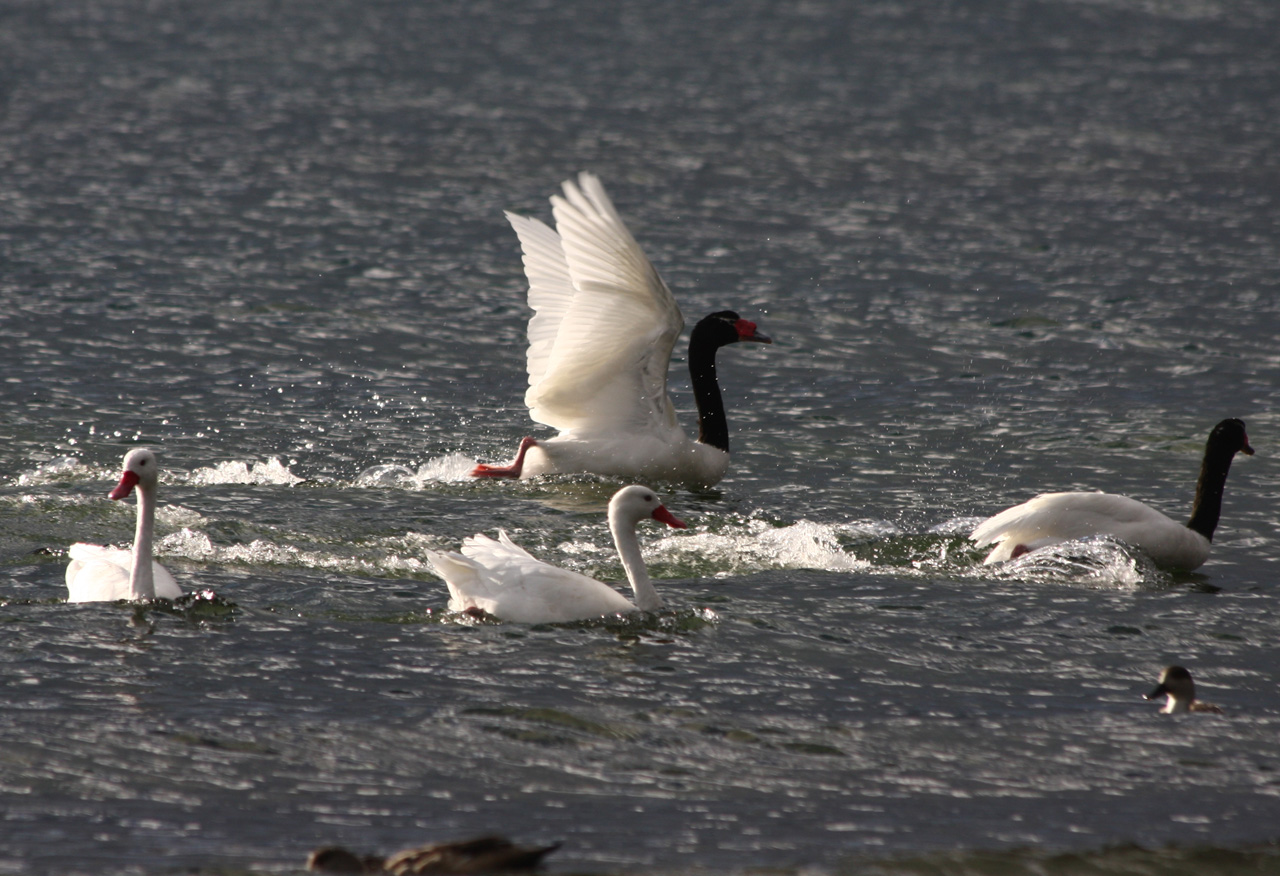
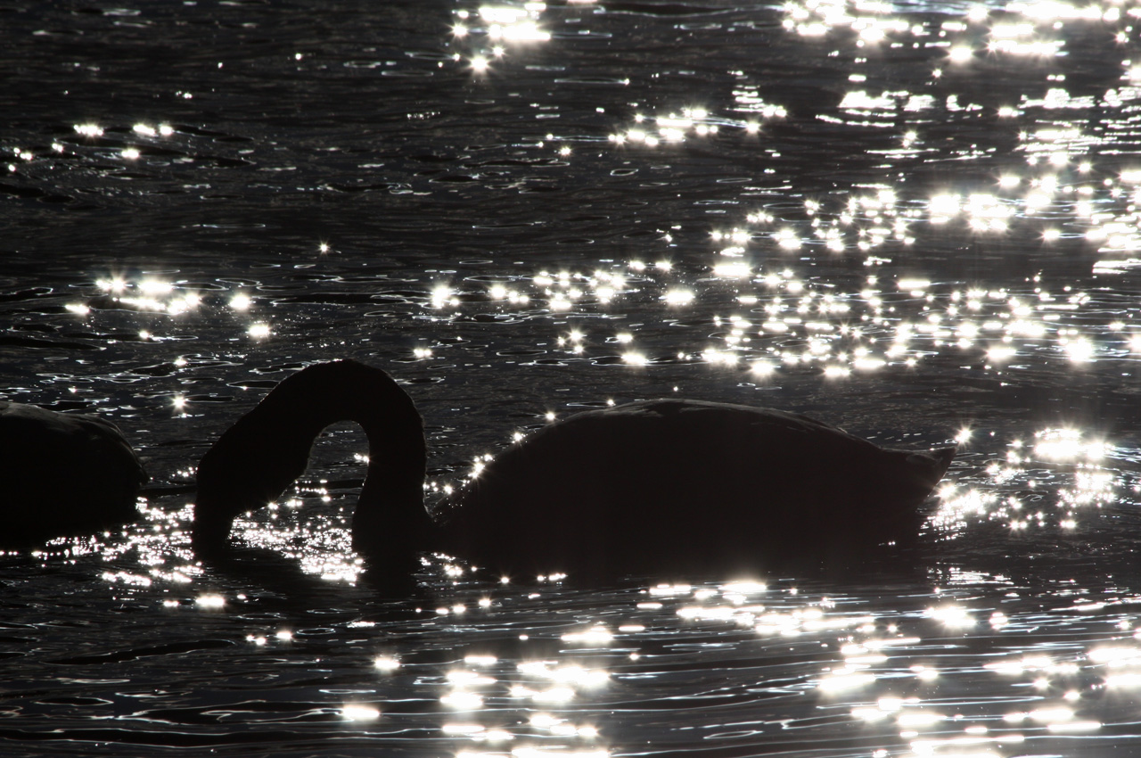
Black necked swans
Los Glaciares National Park (Argentina)
Day 9
Hitting the dark street at 7 we found the bus already waiting for us, as promised. It spent the next 45 minutes doing the rounds of Puerto Natales hotels. I was anxious about crossing into Argentina because I had read that every Australian must pay $100 US on entry, whereas Les and I had only $180 US cash between us. I presumed that payment in Chilean pesos would not be accepted at the border. Accordingly, we made up some contingency plans: (a) If I were ejected from the bus then Les would meet me the next day at the station at El Calafate (by which time I would have gotten the US dollars), (b) I'd ask everyone on the bus if they would change Chilean pesos for US currency, (c) Les would enter Argentina on his Polish passport (Poles do not pay), and (d) we'd email each other if plan (a) failed.
When we arrived at the border post everyone disembarked and lined up to be processed by the bored official. Les did not need to pay anything so things looked pretty good, until I noticed a photo of the Chilean woman president on the wall. This was the exit from Chile, not the entry to Argentina. Gringos can be pretty thick! It turned out that both of us had mislaid an entry slip we had been given on arrival in Santiago. We both later found these, but it didn't matter, though the official did grumble somewhat. Three kilometres later, we breached the Argentinian frontier. They didn't ask anyone for money and we certainly weren't going to suggest paying, so all that anxiety had been for nought.
From the bus we saw rheas (large flightless ostrich-like birds) darting around and guanacos (a kind of lama) crossing the road. Apart from a turquoise lake, the landscape was arid and drab all the way to El Calafate. Having no Argentinian pesos we could not buy food or drink, but we used Les' card to buy tickets on to El Chalten, billed as the trekking capital of Argentina. We arrived at 4.30 in this small and bustling tourist hub. I gave Les the bad news that I didn't feel up to doing the icecap circuit (sorry, Les), as five more kilos of weight would have weighed me down really badly. We holed up at the pleasant Posada Altas Cumbres, which featured high wooden ceilings. Huge steaks (380 gms) followed - welcome to Argentina.

Pet goat in mid siesta

Our first view of Mt Fitz Roy
We left our pleasant El Chalten hotel at 8 and followed Les' compass bearing for north, where there was supposed to be a camp ground. Not so. The trail climbed and the wind was strong in exposed places. First we passed through woods of beech. This is the only tree species in South Patagonia, as far as I can tell, though it varies greatly in size. We camped at Poincenot then walked to the Laguna de Los Tres, a green lake below Mt Fitz Roy, which was obscured by cloud. The guidebook said there is a path up Cerro Madsen (1806m), but instead of looking for this, we set off from the viewpoint. The mountain is almost entirely covered by broken rock. Les went up the ridge, where he found a faint path; I ascended the face, which is more difficult. My progress became slow as the scrambling became more challenging near the top. Les reached the summit before me, except that it wasn't the top - we had climbed a false summit a little below the main one. It was sheer coincidence that we met here. Seeing we had not made any agreement regarding where to meet if we didn't join up at the summit, this was fortunate. We decided we would not split up again without a clear back-up plan. Our ridge offered terrific views of the pale blue Piedras Blancas Glacier spread out below us. We decided not to bother going down from ours and then up to the main summit, as Mt Fitz Roy was not visible. Altogether, it took us 3 1/2 hours to go up and down Madsen.
As we returned to the campsite the wind picked up handsomely, so that I walked like a drunkard, attempting to keep my footing. If not for the railing on a small bridge on the Rio Blanco I would have been swept into the water. Back home at 7, Les suggested we go to Lago Sucia. I wasn't keen but agreed to go. About half way there I was even less keen, as my diarrhoea was rumbling, it was starting to rain and I had forgotten to take both the toilet paper and my Goretex jacket. In addition, the path was very rough and slippery, requiring some scrambling, and marked as 'dangerous' on our map. When we were about 15 minutes away from the lake Les said we should turn back, as he thought we might be caught by darkness. I reluctantly agreed, so we never saw Lago Sucia from below. Back at Poincenot we realised we would have just made it back by 9, when it gets dark. Another small regret.
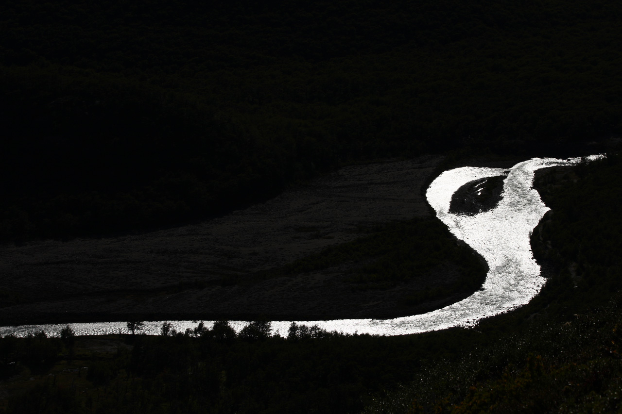
Rio de las Vueltas

Cerro Madsen, which we climbed
Aguja Poincenot
Piedras Blancas glacier seen from Madsen summit
The Laguna de los Tres seen from Madsen summit
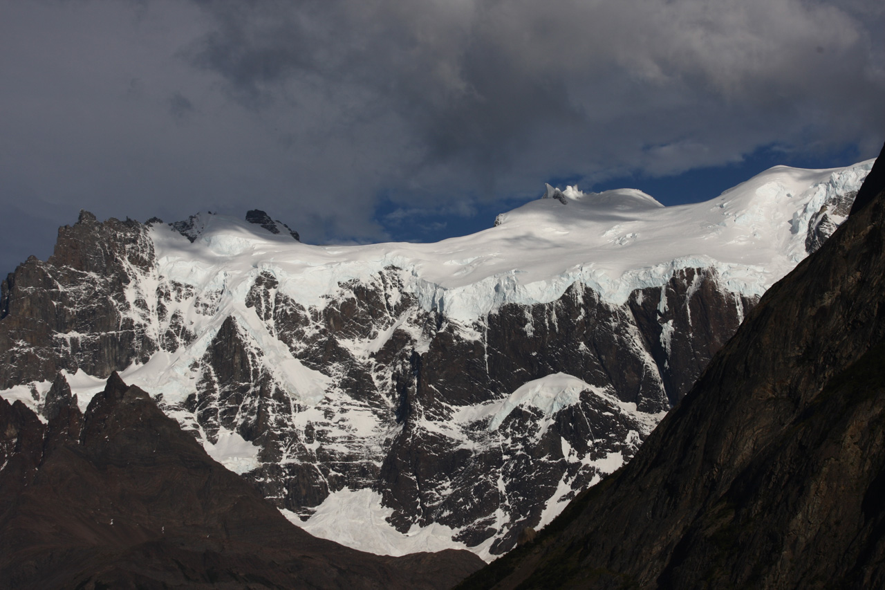
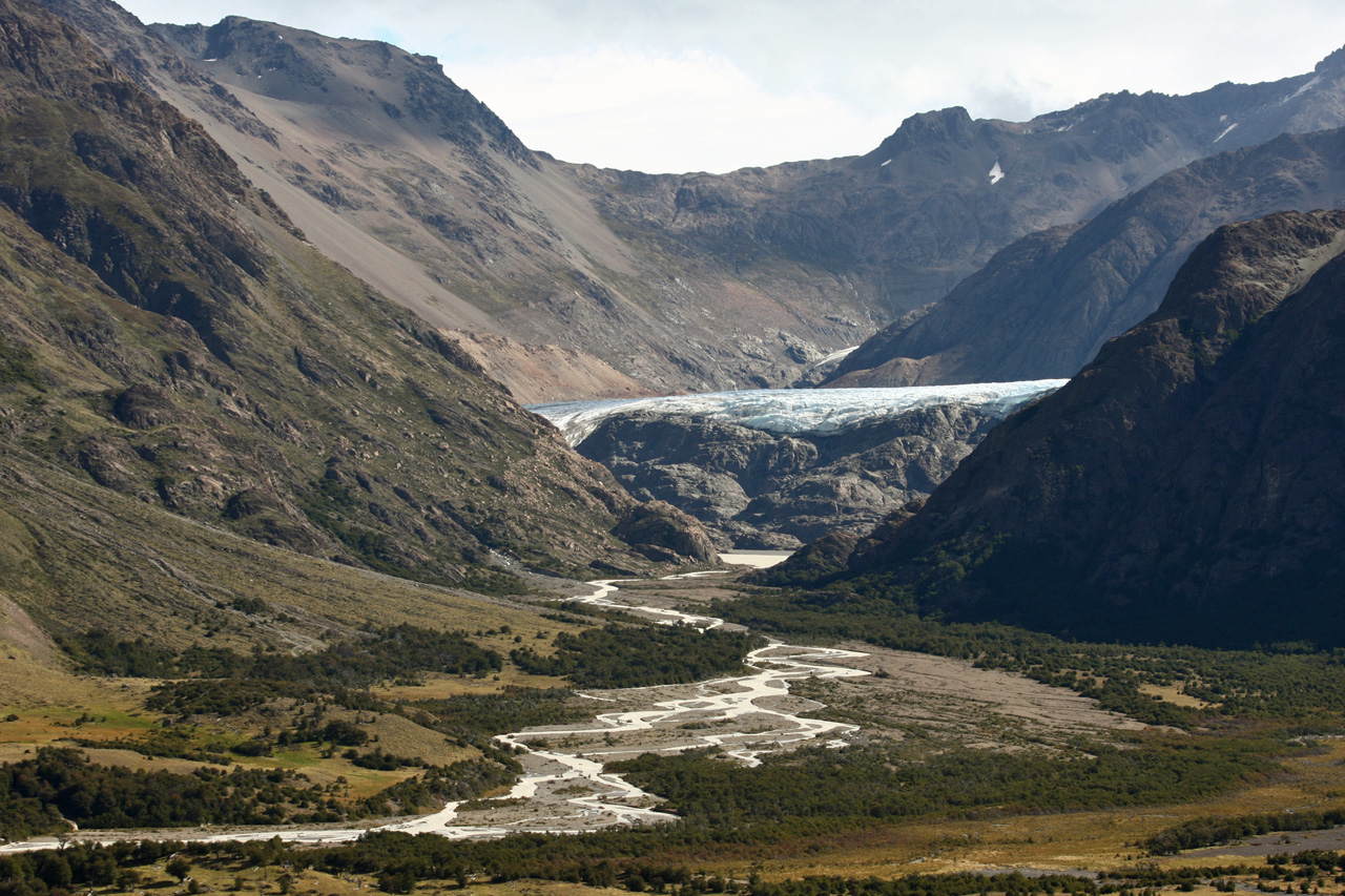
The morning was sharply cold as we packed up the wet tent, causing my hands to freeze up. We set off in unsettled weather, following the Rio Blanco down valley. I enjoyed eating the red and the pink berries on the way. We planned to view the Piedras Blancas Glacier but there was no sign for it. When I caught sight of a glacier I prevailed on Les to have a look, though we thought that it was not the right one (which it was). Access involved hopping over large granite blocks on the bank of the exit stream. We soon had a clear view of the glacier and the lake it creates. Les suggested (perhaps only half meaning it) that we walk right up to the glacier. I eagerly agreed. It was further than it looked and the terrain became unstable as we approached the icefall, walking along the lake. We came right up to the glacier but did not step onto it, as there were occasional rocks falling. I was really interested to see a glacier from so close and to see its underside.
We ate our measly bars and then needed to cross the river flowing from the glacier. Wearing our packs it was not easy to negotiate the boulders across the vigorous stream. Further down the valley we became uncertain of our progress as we seemed to have gone too far. It was a relief to reach the park boundary, where there is a fence and a style to cross over it. From then on we were on the terrain of a huge private property (which allows trekkers in). We began to look for the left turn up the Electrico Valley, following the cairned path. However, we missed the turn-off, reaching another fence. We retraced our steps and looked around for the new path, finally chancing on a sign for "Piedra del Fraile". We now walked up the Electrico Valley through a wood. There were various paths but little chance of going wrong since there was only about 200 metres of space between the river and the escarpment, ie nowhere else to go. The path seemed interminable, so that I said to Les that if we didn't see something within half an hour we should rethink. We passed some tame horses which ignored us. Fifteen minutes later, we sighted a building, the first since we had left El Chalten yesterday.
We walked into the rustic dining room, where a cat dozed next to the hot stove and a Russian-German couple spoke English among themselves. The friendly senora who runs the Refugio Los Troncos cooked us tasty and fortifying vegetable soup. The Troncos is the last outpost of Argentina. Beyond it stretches the immense Southern Icecap, with Chile on the far side. We were shown into a cold cabin with four bunks, all for us. Les suggested we go to the Piedra del Fraile, an outcrop of rock from which the Icecap and the Lago Electrico are visible. Trekking up the wide and flat valley, we struggled into the wind, which slowed us down and pelted our faces with light hail. Les strode quickly up the path to the top of the Fraile. From the top we could see the Icecap as promised. Then Les unwittingly set us up for another "boys' own" by suggesting that instead of retracing our steps on the path, that we take a short-cut down to the path below us. I, of course, agreed. As usual, we started out OK, but it became increasingly tricky. I negotiated a cleft in the rocks, with Les following above me. He shouted for me to watch out as he let loose some large rocks, one of which hit my heel. Then he shouted again. This time I sprang right out of the way, which was lucky, as an even larger rock came flying. Les cut his hand and needed a plaster. I got away with minor cuts and bruises. Now Les called the retreat, so we climbed back up to the path and then descended routinely. I suggested that we hurry back to the Troncos, as I was worried that our senora might close the kitchen for orders earlier than 8.30. So I raced back, only stopping for one photo (a record?). Les remarked that I speed up a lot when the goal is in sight. We made it with lots of time to spare and were rewarded with tasty home-made canneloni and hefty but dry schnitzels.
Granite
Piedras Blancas glacier

Piedras Blancas glacier
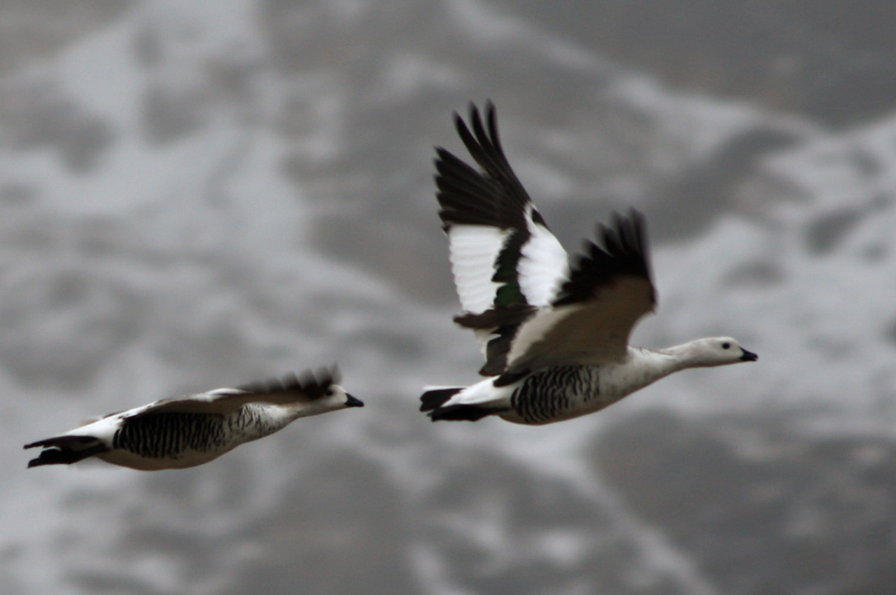
Magellan geese
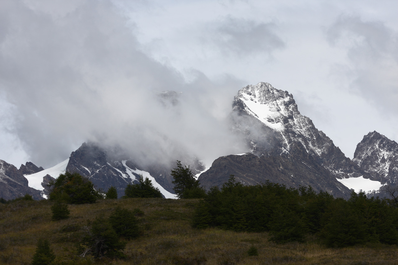
The night was not cold, despite our fears, so we slept in and got up just before 8. Our intention was to climb part of the way up Mount Electrico. Following the guidebook, we took the path up the wide valley and nearly reached the Piedra del Fraile before we realised the directions were misleading us, having wasted 40 minutes. We chanced upon a very faint path (later discovering that there was also an "unmissable" one). It was a perfect day, sunny and remarkably, with almost no wind. We met three Argentinians going up to the Paso Cuadrado and decided to go there instead of up the Electrico, as I expected a view into a new valley and we probably would not have made it to the summit of the Electrico. Meanwhile, the views kept getting better, of Mt Fitz Roy just ahead of us, of the Icecap to the north and of the Electrico River valley behind us. The Paso Cuadrado is a pass at 1700m next to a square bluff of rock and it looked a deceptively easy destination.
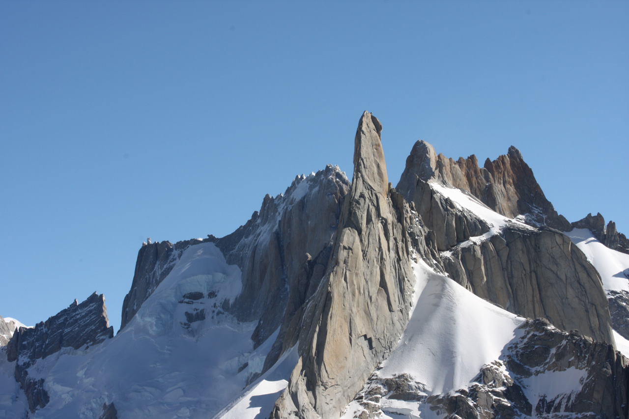
As we didn't have crampons I did not want to risk walking up the glacier, so we clambered up the rocks. As usual, this got harder and harder, obliging us to use cracks and chimneys. Les chose a good line, so that we were soon above the Argentinians, who had gone on ahead. Presently, we came to a corner I could not negotiate wearing my pack (as it pushes you away from the mountain) so I dumped it. Then the rock wall ahead became too hard to climb. Since I didn't want to risk walking on the snow of the glacier, the only other alternative seemed to be to walk on the edge of the snow where it meets the rock. This too was not feasible, as the snow would not hold up under our weight, being hollow underneath. Although we were only a little below the pass, I was just about ready to give up, when Les had a creative idea. I have not seen any mention of his method in the climbing literature, so it may be a world first. It consisted of sitting on the sloping rock near the edge of the glacier, with our feet resting on the snow. We moved our feet up the hill while remaining in a seated position. A variant on armchair travel! This got us through the difficult part and then we could walk on the edge of the snow. We didn't realise it, but this took us the width of the pass. Then we climbed again, with some rather difficult bits. Each time it got worse, Les said, "This is a joke!" and threatened to tell his mother on me. With much effort we finally scrambled onto the ridge to imbibe the view that opened out. It included two dramatic spires, Cerro Torre and Cerro Pollone, and a new glacier (naturally). We now realised we had climbed too high, as we were above the actual pass. There was not long to savour the view, as it was 4.15 and our dinner was looking doubtful. (Actually, we consistently over-estimated the time needed to descend on the trip.)
The descent was no harder than the climb. We found the backpack and now it was my turn to wear it, as Les had carried it up. It was hard to recall which way we had come up, so we varied on the descent. It was always a challenge to pick the right route, as it could be good for a while then become impassable. We met the Argentinians again, who had also begun descending. At one point, their leader showed me the way to descend a difficult part, but even this required a controlled slide. Soon, progress became easier, with only the occasional dead-end. We passed the bright green lake and then the frozen one and, for the first time since the pass, found the path. A rapid descent followed and I did not lose the path, not even once. We could soon see the Troncos roof and reached it at 7.30. All of ten metres from the building was a large sign pointing out the path.
Today was the highlight of the trip for both of us - perfect weather, marvellous views, challenging climbing and a sense of accomplishment. Both of us extended our climbing capabilities during the ascent. It would have been easy walking up the glacier in crampons, but on the rock it was far from straightforward, with occasional anxious bits. At one point I lost my footing and hung by my hands. Both of us suffered small falls, but nothing damaging. We had very sore fingers from grasping the rough rock and Les left some blood at the pass.
Rio Electrico
The edge of the Hielo Sur at Paso Marconi
Mt Fitz Roy
Cerro Pollone seen from Paso Cuadrado
Today was our only entirely rainy day. Precipitation was not heavy but the wind spattered it into us, magnifying the effect. The return path from the Troncos looked straightforward but at one point we realised we had gone too far down the Electrico Valley. We debated and tramped back and forth for about half an hour. I recognised the hanging glacier signalling where we were to turn, but this was not enough, as it was far above us. We backtracked half a kilometre then took a small path leading up the right valley. Lo and behold, we found ourselves at a familiar place - the very spot where we got lost last time. From here we found the singposted turn-off and had no further navigational problems. We had thought of going to Lago Torre today, but the weather worsened. As Les put it, "It is discouraging."
We reached El Chalten in the early afternoon, got information about the Paso del Viento, hired harnesses for the Tyrrolean crossing, ate dinner at a posh bar and repaired to our nice room. Sadly, the long-awaited shower didn't materialise, as hardly any water came out of the shower-head. I neglected to book my flight to Buenos Aires.

Aguja Poincenot and Fitz Roy (both at right)
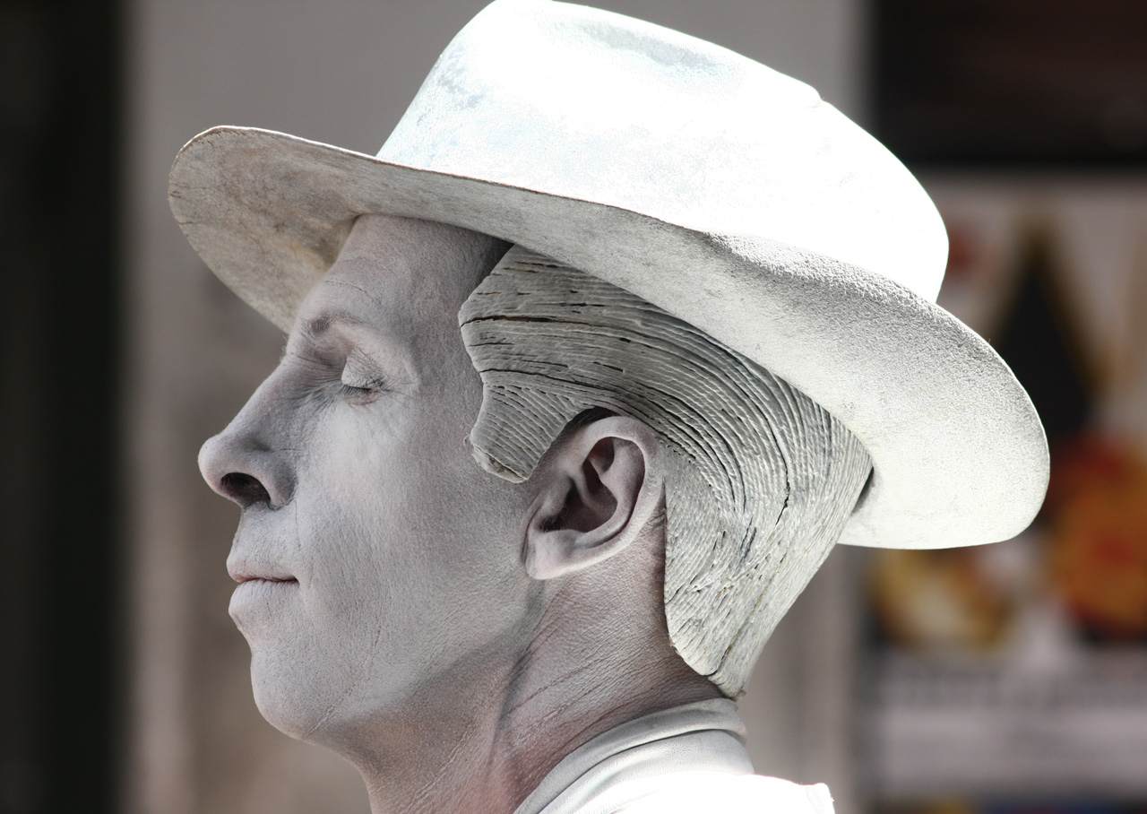
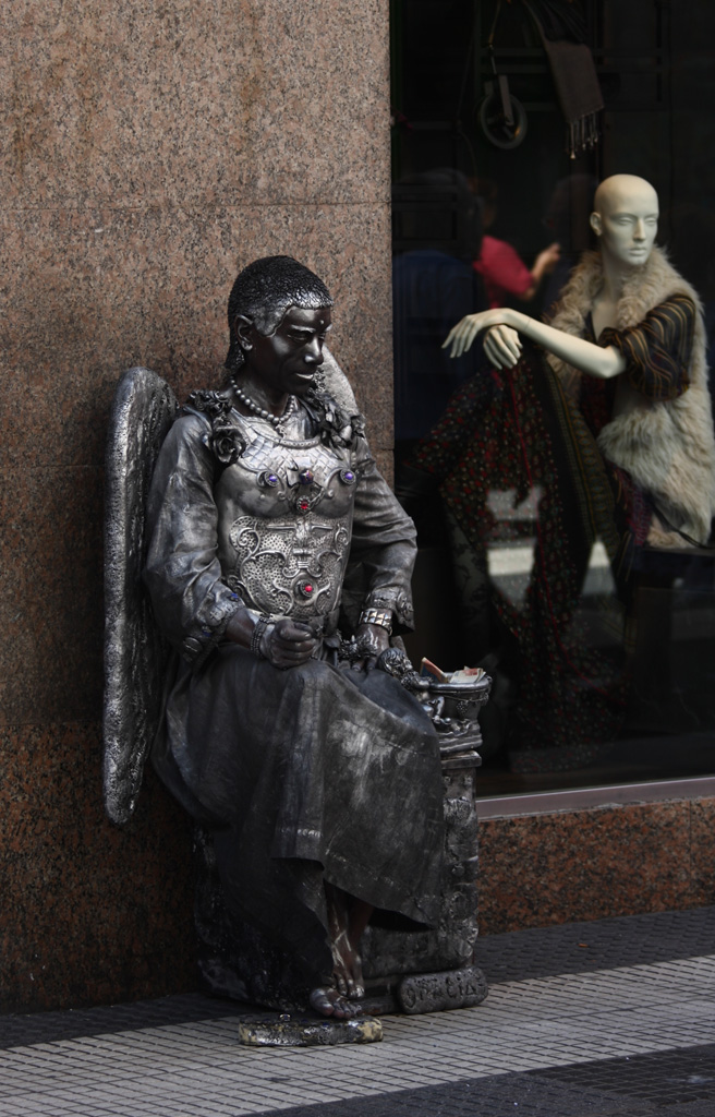
Take a close look at his complexion
We left the hotel at nine. I went to ring Aerolineas Argentinas while Les fetched batteries for his camera. The telephone centre near our hotel was busy, so I decided to use the one at the far end of town, only to find it closed. The sign announced it would open at 9.30, but this is South America. I tried various other options, getting increasingly flustered, as we had a fair walk ahead of us and Les was waiting. Eventually, a hotel receptionist rescued me. He didn't want to initially, as it is not a normal service for non-guests. He also didn't know how much to charge me for the call. I told him I'd pay more, but in the end he did not want any payment. (I gave him 10 pesos.) Afterwards, by way of explanation, he said that I would do it for him. I answered, yes, for him or someone else. The entire episode was stressful, as Les was waiting for me and we were eager to make a start. The phone line kept dropping out, there were language difficulties and bureaucratic niceties that slowed down the process, but eventually I made and paid for my flight booking to Buenos Aires. I joined Les at the Park Office, where we received a (free) permit to walk to the pass. Our blast off time was delayed till 10.30, a bit late for what looked like a longish walk.
At first the track was very distinct and even had signs. We saw a few people during the first few kilometres, then no-one for the rest of the day. We were treated to our best views yet of Mt Fitz Roy, as the day was clear. Otherwise, the route was not so interesting, until it began meandering and splitting. Often it was hard to tell which was "the" track. Les would ask, "Is this a stream or the track?" I'd answer, "Probably both". The Bradt guidebook confused things by telling us to make a turn that never came. I half believed that we were lost, though I had not seen any viable-looking alternative paths. So it was with great relief that I came to a sign for Lago Toro at around 2.15. The guidebook indicated there were now two possible paths, one straightforward, the other "far more difficult to follow". Les insisted on embracing the challenge of the harder path, since it promised a view of the Hielo Sur (not true, as we later learnt) and I reluctantly agreed. The instructions were to go "slightly left" along a faint path, then to cross a forest. There was no path at all. We followed the vague directions as best we could, with Les powering rapidly up the bare hill that came after the woods. He is indefatigable even with his 17 kg pack, so I lagged behind. Eventually, we reached a summit that looked out onto the Tunel River valley and the glacier above Lago Toro. At the time we were unsure of this as we struggled to prevent the wind from tearing our map.
Our not so reliable guidebook suggested to go down the hill to the river, and that it did not matter where one descended. What it omitted to mention was the difficulty of getting through the intervening forest. We were hundreds of metres above the Tunel River and it was far from clear how to reach it. I suggested that we descend obliquely towards a distant clearing and Les agreed. Our descent was long and involved avoiding swamps, crossing a stream on a log, penetrating through a thicket and then passing through a forest of high trees. Eventually, only grasslands separated us from the river and then, unexpectedly, I noticed an obvious path only a few metres from us. It was easy to follow this all the way to the Lago Toro campsite, where we arrived at 5.15. The only difficulty was having to take our shoes off to cross a frigid stream. So another "boys' own" ended happily.
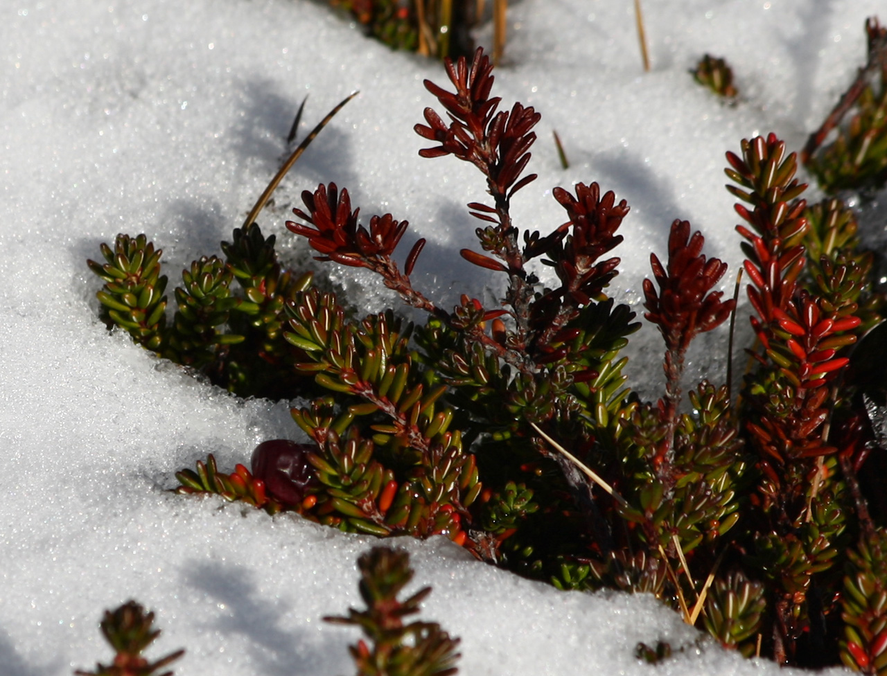
There was one other tent at the campsite but no people. I spied an interesting-looking path that climbed above the camp. Les said I always pick the hard ones but he went along. It was a tough ascent over sharp rocks that could cut our hands. At the top there was a catabolic blast of wind, so that I could not stand up without holding onto the rock. The view was not particularly inspiring. On the way down I admired the brave plants that manage to take root in these harsh conditions. Later I walked to the Tunel River to fetch milky water from glacial melt. Les thought it wasn't good for making tea, but I did not mind.
Remnants near the vegetation line
Another brave plant
Frigid creek
Rio Tunel valley
Day 15
Our schedule today was a big push for the icecap (the Hielo Sur), so we began walking at 7 when it was still dark; I using my headlamp. Wind, drizzle and the grayness made it a low-key start. Since I was leading we soon lost the path, taking Les on yet another gratuitous climb. When we got down we found the path, only to see it immediately interrupted by a raging torrent. Here a sign warned of danger and that the National Park absolved itself of any responsibility for people using the installation. The installation in question was a wire strung across the chasm. Although it looked to be securely attached I felt nervous about doing the Tyrolean crossing and scouted for a place to wade across the stream, in vain. Les, however, was confident and went first with the backpack. He put on the harness and attached it to the wire with a karabiner on the end of a rope. As I filmed him making the traverse I was puzzled why he kicked his legs in the air. When it was my turn I understood. The wire was angled somewhat uphill so the karabiner did not slide easily on the wire. It needed to be kick-started every time one pulled oneself a few centimetres. It was such tough going that each of us needed to rest hanging from the wire before completing the crossing, especially the last few metres, where I needed to stop repeatedly. I wished I had worn gloves, as pulling on the wire mangled my hands. I had felt apprehensive but not scared making the crossing.
We were now in the wildest and most remote part of the park, a true wilderness. However, there was still a path of sorts, marked with cairns, though it disappeared when we reached the Rio Tunel Glacier. Since the glacier is moving, it is not possible to mark a path on it. Despite having read that we should walk on the glacier, we traversed along the unstable scree of the lateral moraine, which was tough going. In places there was ice visible below the rubble. When we went down to have a closer look at the glacier and an ice cave beneath it I slipped and fell, breaking the lcd screen on my Ixus. Luckily, the camera has an optical viewfinder and continued to function, as did its operator. We admired the ice cliffs from just below before crossing onto the glacier itself. This is partially covered with dust and rock so it is easy to walk on it without crampons. There are many crevasses but they are of no concern, as they are easily avoided due to the complete absence of snow. I enjoyed walking on the ice as I had never been on a glacier without snow-cover before.
When we crossed to the other side we moved back onto the scree and admired the brilliant views. In addition to the glacier we had just crossed with its lake, the Laguna Toro below, there was another lake and the blue, heavily crevassed glacier above it. Higher still were snow fields leading to dramatic spires and snow-clad mountains. We soldiered on till we found what looked to be the right path, zig-zagging its way up the mountainside. After climbing steeply the track began to traverse. Les noticed another path below us and persuaded me that the other one was the path to the pass. As we still had hundreds of metres to climb, we didn't want to go down, so we traversed towards the second path. When this failed to materialise we held a conference. One option was to go down till we found the path again, as we were now in no-man's land. The alternative was to just go directly up the escarpment. The problem was we had only 90 minutes till our agreed on turn-around time of 2 pm (which was much too conservative, as we later realised). I was keen to go straight up, hoping we would see the pass. Les agreed, so we walked as quickly as we could over mosses, small streams and rocks. It looked as though the top of the ridge was not far above us, but, as always in the mountains, there was another ridge above it. However, at 1.30 some new snow-clad mountains began to be visible. Ascending a little higher, we saw a lake and then a 180 degree panorama.
We were at the fabled Paso del Viento (1428 m), a prime viewpoint onto the 300 kilometre long Southern Icecap. Vast, cold, impressive, forbidding and of course, inviting. There was wind, as promised by the name, but not strong by Patagonian standards, as I was able to stand up without using hand-holds. Both of us had believed we would not reach the pass in time. So I was extremely pleased that we were here, with half an hour in hand. Les said he was happy that I was happy, but he too was pleased.
Like the Paso Cuadrado, the Paso del Viento was one of the top highlights of our Patagonian foray. The views were superlative, their grandeur surpassing anything in the more famous Torres del Paine. The Paine park is on a smaller scale, less wild and also less challenging. It was great to finish our tour on such a high. The effort had been large, but so was the reward.
Somehow, we forgot to look for the path on the way down and had descended a hundred metres before we noticed it traversing above us. Les and I deserve each other. This was the same path that Les had us abandon on the way up. So yet again we traversed and climbed till we reached the faint band crossing the scree. This track took us all the way to the Rio Tunel Glacier, which we crossed again. However, we got off it a little too early. Then more scrambling over the scree till I noticed an intriguing path that wound down through a narrow gorge. My secret agenda was to avoid the Tyrolean crossing, which was possible, according to our map. However, Les convinced me this would probably waste a lot of time, so it was back to the wire. This time, I wore gloves, which made it easier, but was unnecessary, as it took minimal effort to cross in the downwards direction. The path took us past the Lago Turquesa, where we disturbed some Magellanic geese. We had not seen this scenic little lake on the way up. Then came Laguna Toro and at 6.15 our friendly tent. Conveniently it was already erected. I celebrated with my favourite dinner - chicken tikka. The other tent that had been there before was gone, but now four Argentinians joined us at the camp. When they asked about how to reach the pass I told them to avoid doing it the hard way, as we had done.
Here is a map of our trek from El Chalten to Paso del Viento on days 14 & 15. Our route is marked by a broken red line near the middle.
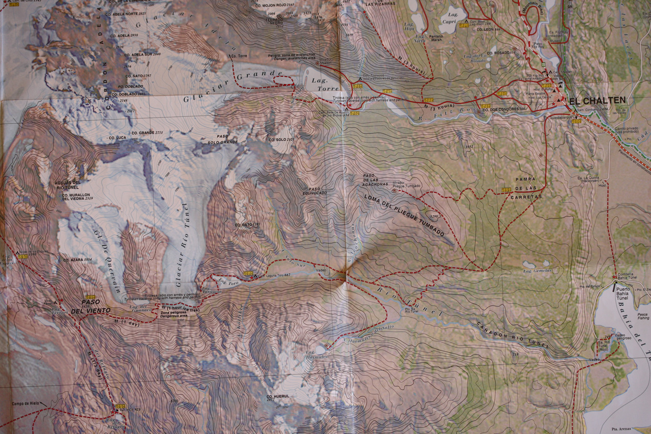
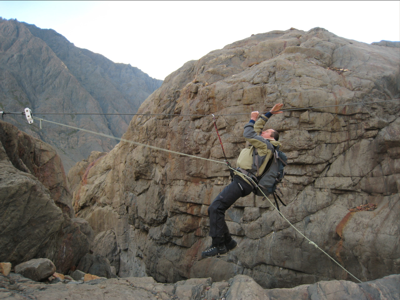
Les making the Tyrolean crossing
The Hielo Sur seen from the Paso del Viento
After a leisurely departure just before ten we followed the path all the way to El Chalten without incident. The river crossing, though only ankle deep, was painfully cold. Our last ever muesli lunch was a welcome milestone. We met two people near El Chalten, otherwise no-one. At 6 we took the bus to El Calafate, where I made heavy weather out of locating our three-star hotel. We pigged out at a really posh parrillada called Casimiro Biguoa. On finishing his slab of beef Les announced, "That was a lot of food. I wasn't hungry before and I'm not hungry now."
~~~~~~~~~~~~~~~~~
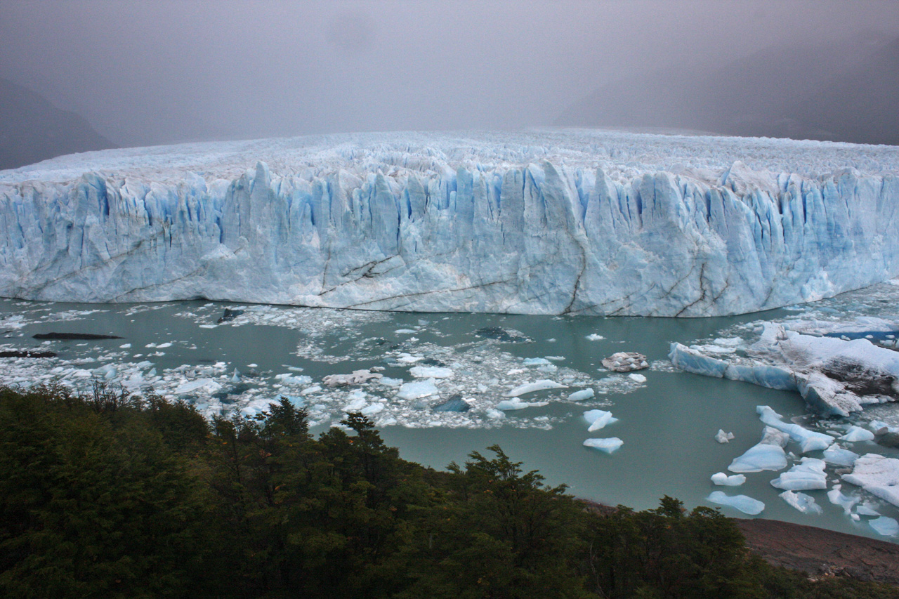
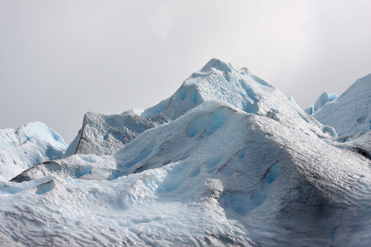
The next day we visited the Perito Moreno Glacier by tourist bus. This famous glacier deserves its reputation. It rises 60 metres above the lake and the glacial calving sounds like explosions. You can see large blocks of ice crumbling into the lake. Although I had worn my rain pants for 72 hours without a break, I did not think to bring them on this excursion (it shouldn't rain on tourists, should it?). Both Les and I got our trousers wet today. However, they dried OK during the bus transfer to the dock. Our tour included walking on the glacier in primitive-looking but quite serviceable crampons. These made walking on the bare ice easy. The organised glacier trek was pretty touristy but good fun, especially since the rain stopped for a while. Back in El Calafate, Les and I settled our accounts, which required reconciling expenses incurred in five different currencies.

I spent most of the day in El Calafate, which is quite a smart looking town. At its airport there was another unpleasant surprise - my flight payment by credit card had not gone through and I had to pay with cash, which was running out. I had only 175 pesos left due to the low daily limit on my credit card. In Buenos Aires I was told there would be no bus to the city for two hours, despite it being only 9.30 pm. I took a taxi to the centre, where I had trouble finding a hotel. I settled for a flea-pit for $40 US, just for one night. As the final humiliation, I walked into a glass wall, bloodying my forehead, something I had never done before. Just after midnight I went to bed in order to avoid causing further damage.

Crane
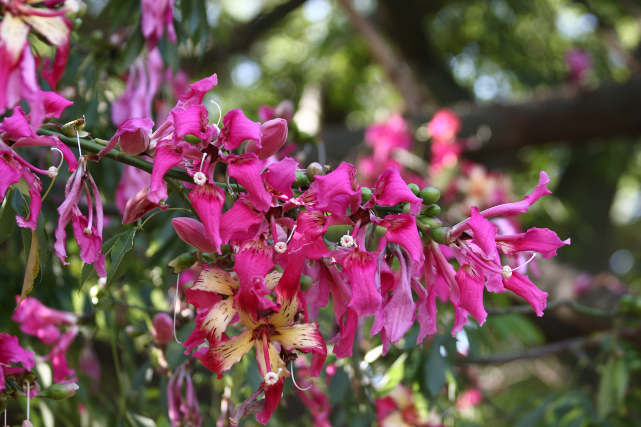
Flowers of the Ceiba Speciosa tree
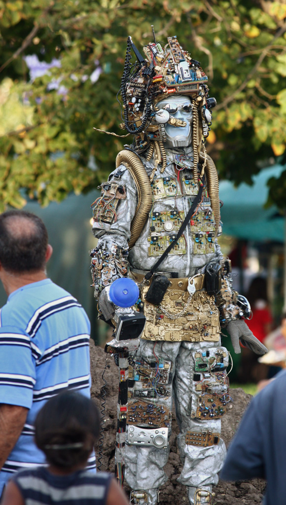
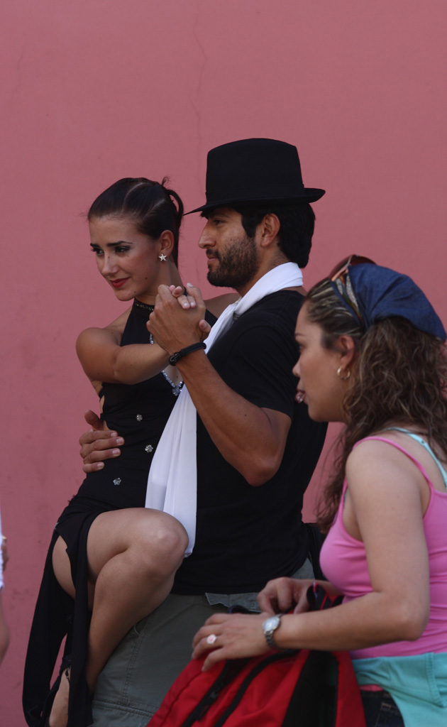
Tango
Summing up
Overall, the Patagonian excursion was a major success, my best ever trekking trip. The aim was to walk amidst great mountain scenery with as little of the clutter of civilisation as possible. I was drawn by the prospect of climbs, being above the tree line, dramatic views, wildlife, circular walks, variety and natural beauty, remoteness, wildness and physical challenge. The last thing I wanted were crowds of people, roads, cars, power lines. I wanted the illusion that we were going somewhere no-one had been before. That was of course far from true, but it was enough for me that the tracks were relatively deserted and showed no signs of human habitation or interference. South Patagonia lived up to my expectations, except that we saw little wildlife, apart from marvellous birds.
I feel hugely fortunate that Les was a faultless companion and that we had the same aims and priorities. Although Les is fitter and stronger than me, I never detected a hint of competitiveness in him. He shows no attachment to an idea just because it is his, which freed me up to be less ego-driven. Thanks, Les.
We preferred the Los Glaciares NP to Torres del Paine, but in truth both are wonderful. The Argentinian park is wilder, less visited, the mountains more impressive, and the tracks more physically challenging and less well marked. By comparison, Paine feels tamer and more touristy, especially on the 'W'. So for those who really want to venture into the wilderness, Los Glaciares is the better option, especially if one goes to the Paso del Viento or even onto the Hielo Sur. In short, Los Glaciares feels more like a wilderness area than Paine does. The biggest highlights for Les and me were the Paso del Viento, the Paso del Cuadrado and Cerro Madsen. These all lie in the Fitz Roy area. Another highlight was the mirador at the end of the Valle del Silencio in the Paine. I think we were very lucky with the weather, as there was no heavy rain and the wind was only occasionally threatening.
There were few mishaps on the trip, occasional disappointments and some unpleasant times. However, the rewards for effort were high. The walking was tough because of the weight. We walked about 151 km during 8 days at the Paine, covering the circuit plus the two side-trips. In the Fitz Roy area we walked for 7 days, for about 91 km, totalling 242 km. Things went more or less as per the original plan, with a few changes. Given the choice we nearly always slept in bunk beds, so we only spent seven nights in the tent. I decided that camping is fine in good conditions, but if it is raining, cold, very windy or mosquito-infested then it is unpleasant. The benefits were that I developed a keener appreciation of home comforts and some perspective on what matters and what doesn't. So long as I was warm, fed and dry, other things could be let go of. I regard camping as a lesson in letting go, including of washing, undressing for bed, and general cleanliness. It is also a lesson in being organised and disciplined, especially about always putting things back in the same, right place.
Would I recommend South Patagonia? If you like being in the wilderness amid dramatic mountains, then definitely yes. It is quite possible to see all the highlights of the Paine park by doing the 'W', which avoids the longer and less scenic stretches, while providing food and lodging. The Fitz Roy area requires a tent and carrying food. Overall, South Patagonia is a wonderful destination.
If you would like to see some more of my shots from Patagonia then click here.