As you may recall, last time I went to the mountains I forgot my PIN number. Not to be outdone, this time I forgot to take the plug adapter for my camera battery recharger, leaving it in Milan with my main luggage. So on arrival in my pleasant room at the Indren Hut in Alagna there was an ugly surprise when I could not plug in the charger. Fortunately, the super-helpful manager lent me a cable of his own that I could use until I returned to Milan a week later.
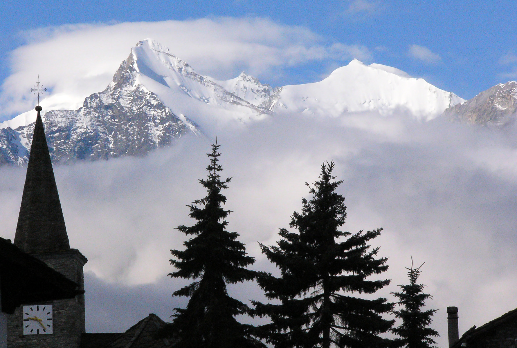
Alagna is a pleasant town that serves as an access point to the high mountains. My intention was to walk the entire Tour of Monte Rosa (TMR) in the seven days I had available before meeting Carla in Sacro Monte. I didn't know whether seven days were enough, so I envisaged taking a train trip if necessary. In any case I knew I had to have a strong pace.
The beginning of the walk was pleasant and gradual. After a little over an hour I reached the Pastore Refuge at 1575m. Then the path steepened as I joined the TMR circuit, but it also became wider, like a causeway, as cannons had been hauled up here during World War I. I met some Italians, including a lovely bitch called Viola, who though initially timid, soon showed her exuberant nature and let me pat her.

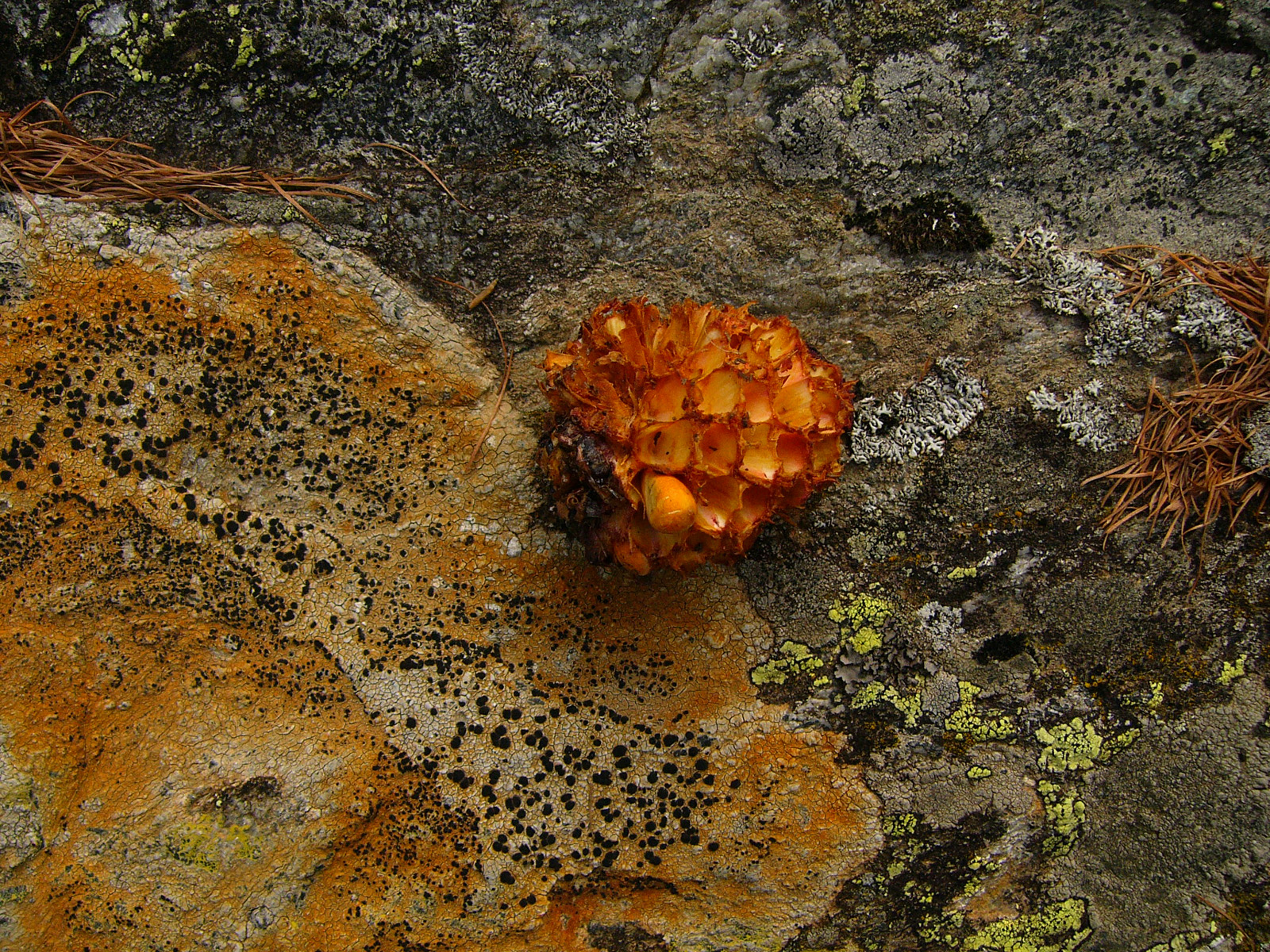
Mountain fungus

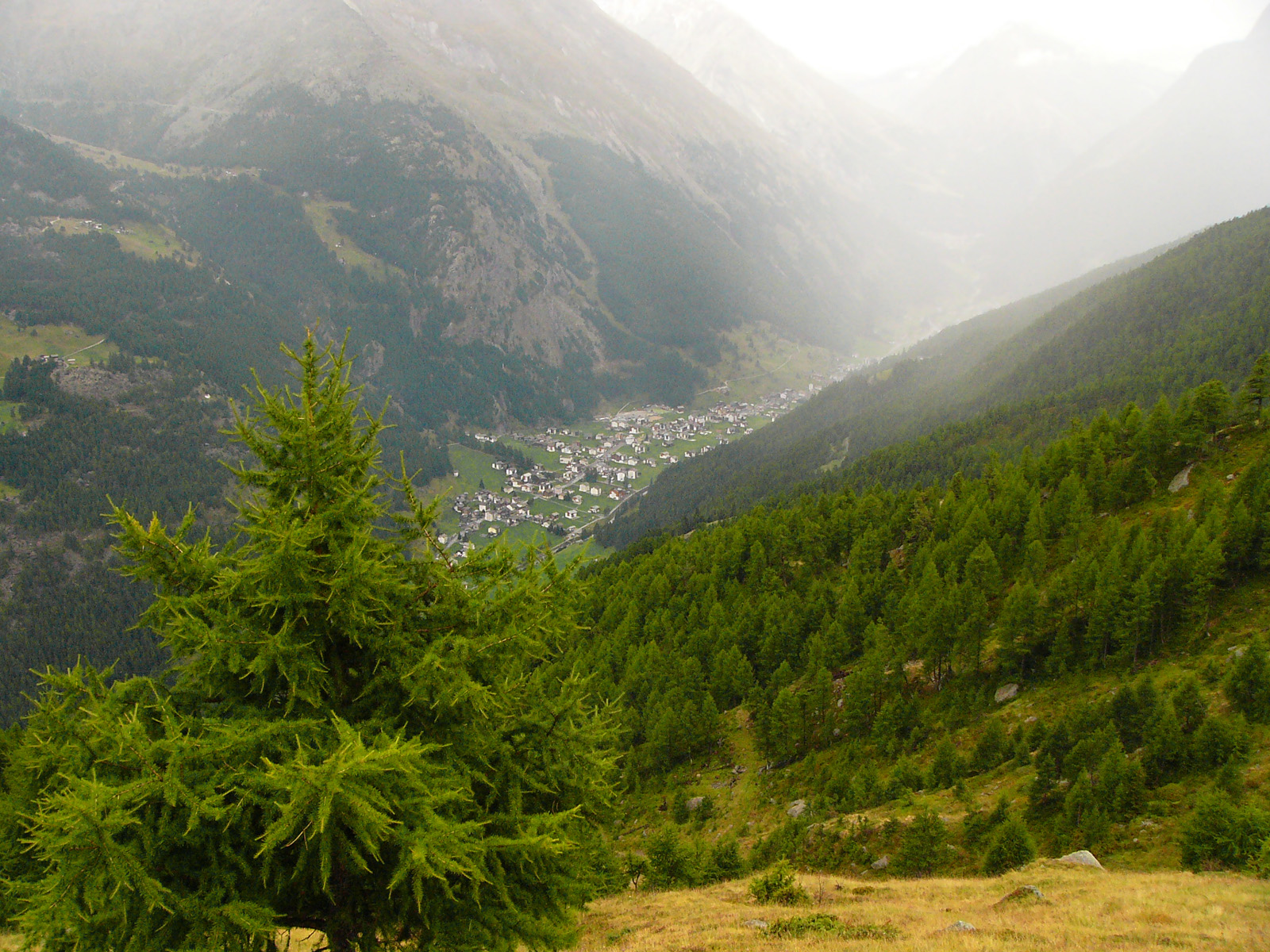
Mountain path
Mount'in equipment

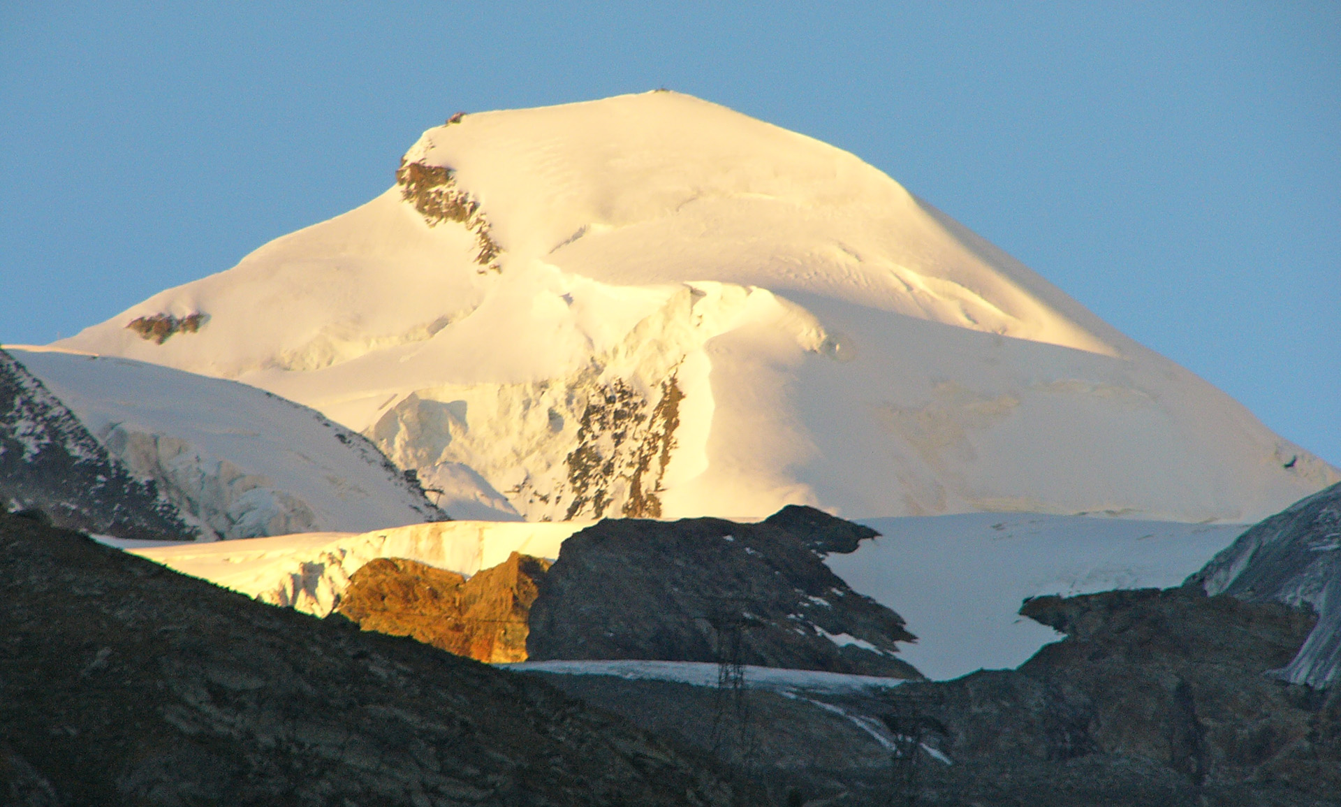
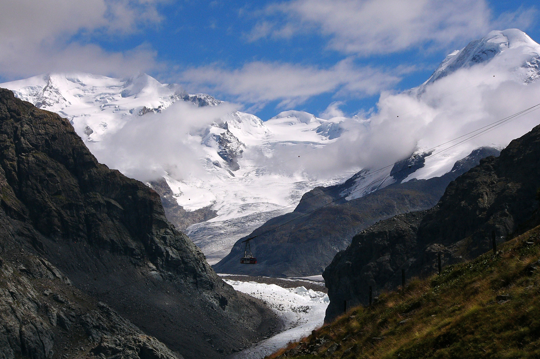
The four main Monte Rosa peaks. I had visited the one at left.

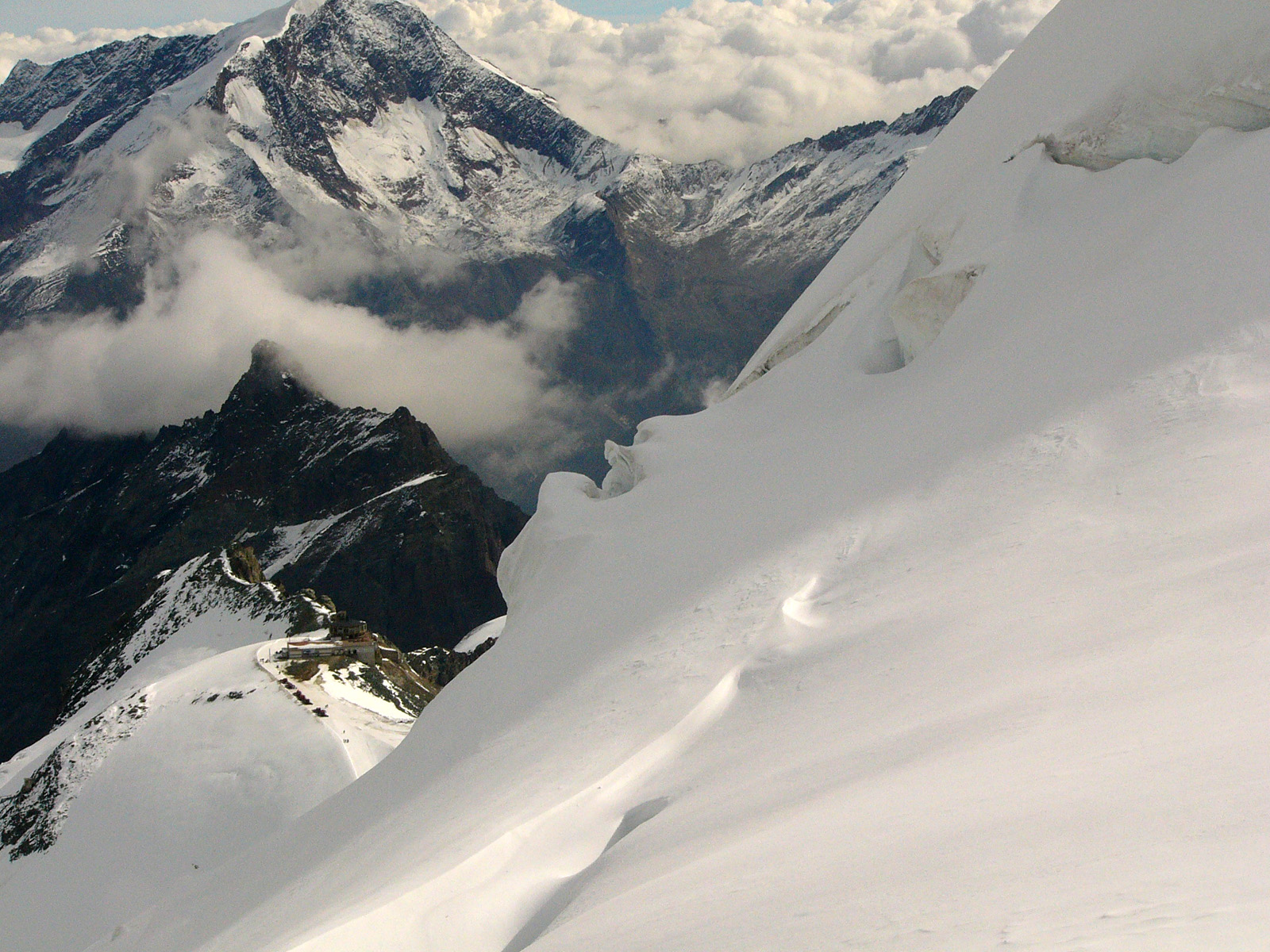
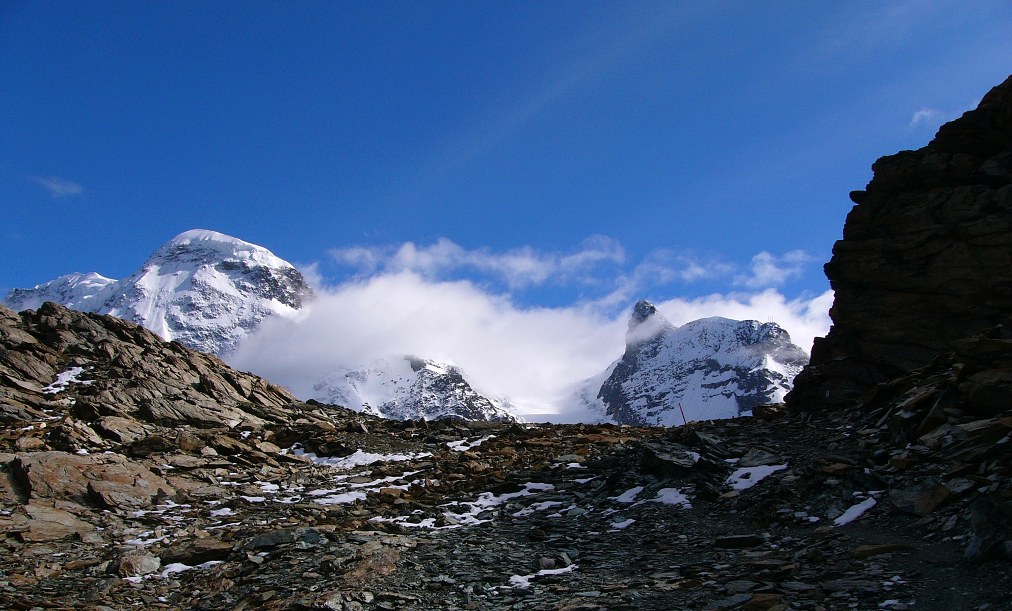
The view into Switzerland
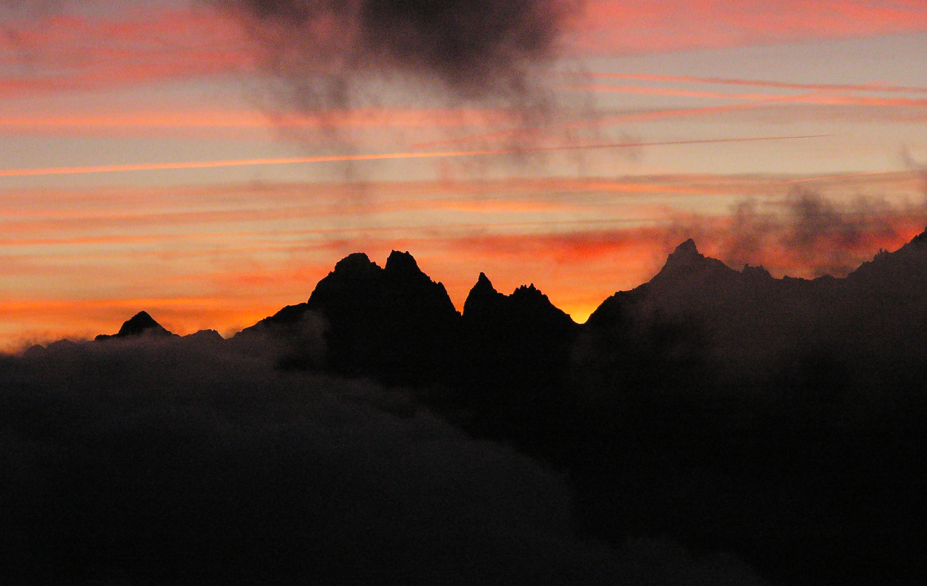
The remains of the day
Our not so fearless hero arrived at Saas Fee (Switzerland) last night and in the morning wondered whether he was up to climbing the Allalinhorn (4026m). I had never set out to climb a high Alpine peak before. Only one way to answer that question. I took three cable cars for the princess-ly sum of 42 euros. The last ride is called the "Metro" and I soon realised why. It is a tube cut into the mountain. One sees nothing at all until one disembarks. Another oddity is that the driver does not face the direction of motion. With just water and the crampons in my backpack, I arrived light at Mittel Allalin (3460 m) at 9.15. I felt trepidation and excitement as the mountain towered above. It looked decidedly dangerous from this side, with nasty crevasses aplenty. What had I let myself in for?
The Allalinhorn
Crevasses off the track
Looking down to the cable car terminus
On this fine morning with little wind lots of people were climbing the Allalinhorn, which did not surprise me, as I had chosen it partly because it is one of the most popular high peaks in the Alps and hence safer than most others. Most people were roped together in groups of two to five people, but there were two other people walking alone like me. I passed a number of people on my way up, as a solitary climber is usually faster than a group. I felt completely in my element walking upwards in the snow in this pristine environment. The crampons made me feel very safe, as they just about eliminate the risk of slipping in the snow, even on steep slopes. I did not feel at risk at any point of the walk, though the altitude did slow me down a little. I had acclimatised over the previous two days, though not at such high altitude.
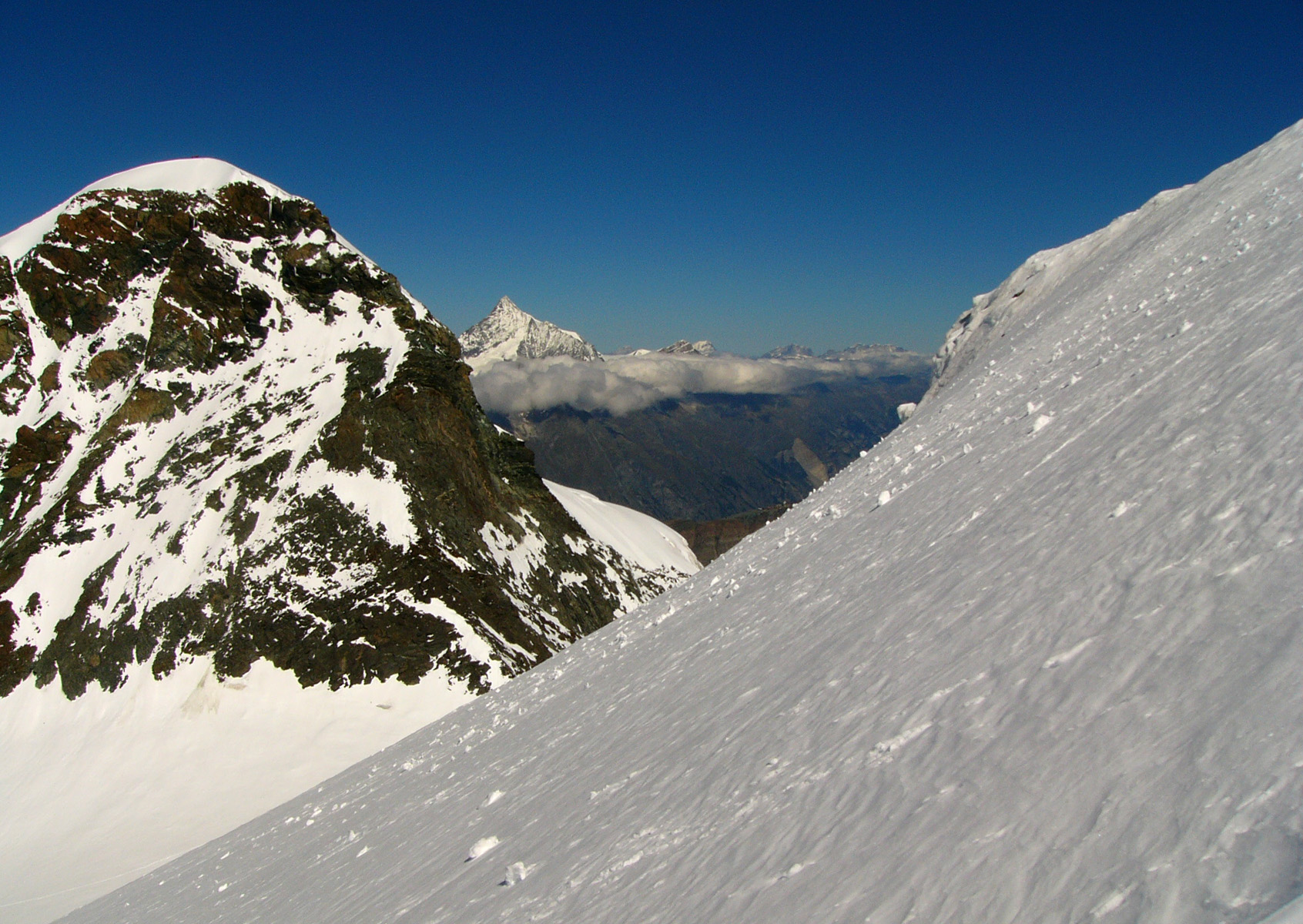
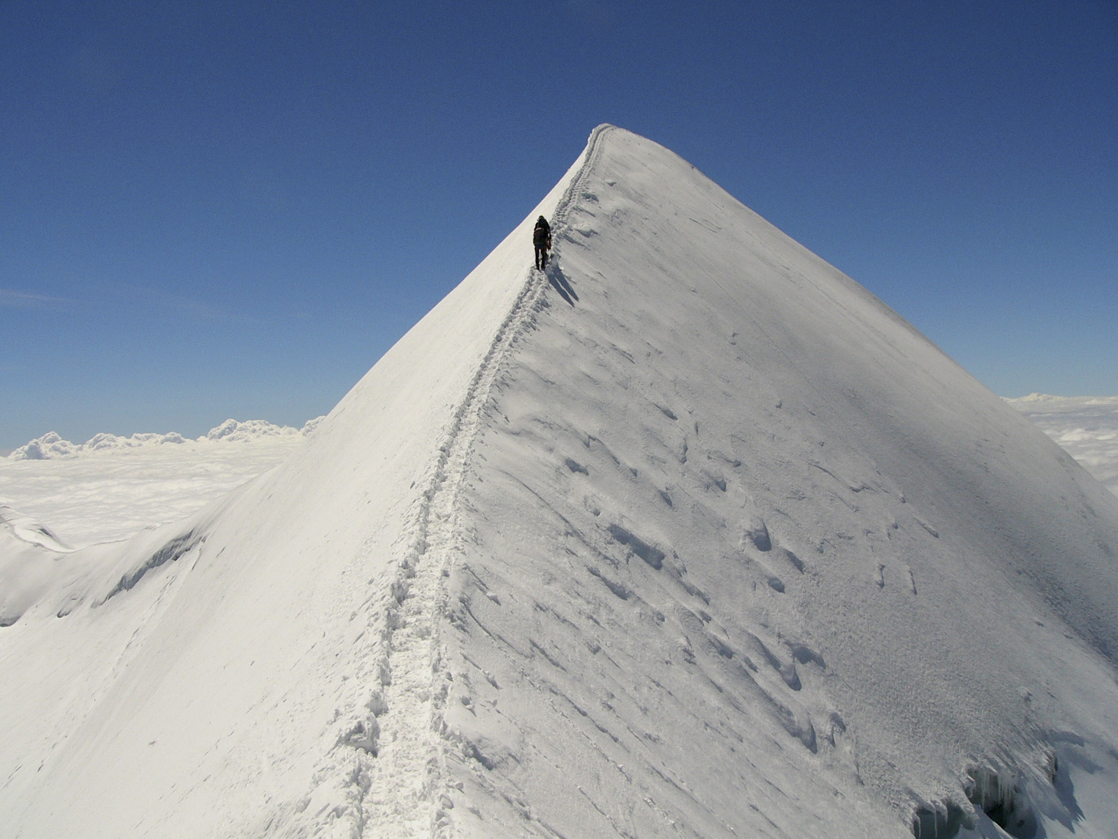
It was warm and the ascent was not tough, though steep in places. The views kept improving as the nearby Matterhorn swung into view. At one point I had to cross a snow-bridge over a four metre (or more) deep crevasse. I found I was enjoying the walk - bad news for Carla and my insurance company. Near the end there were some rocks but no scrambling was required. The summit ridge was narrow but not daunting and almost flat. At the top there is an iron cross where a friendly Italian couple snapped me looking arrogant with the Matterhorn below my left crampon.
Allalinhorn summit ridge
Looking down from the summit
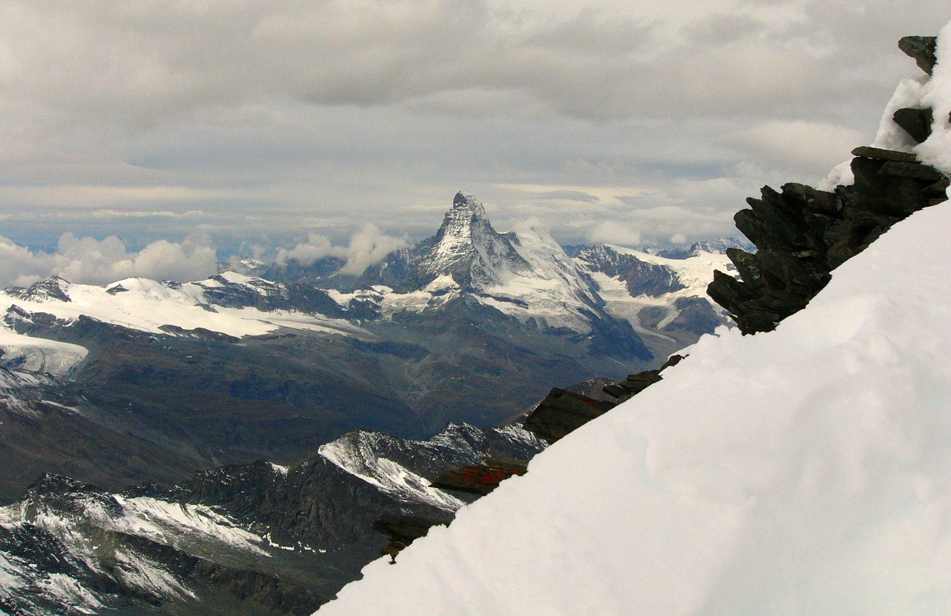
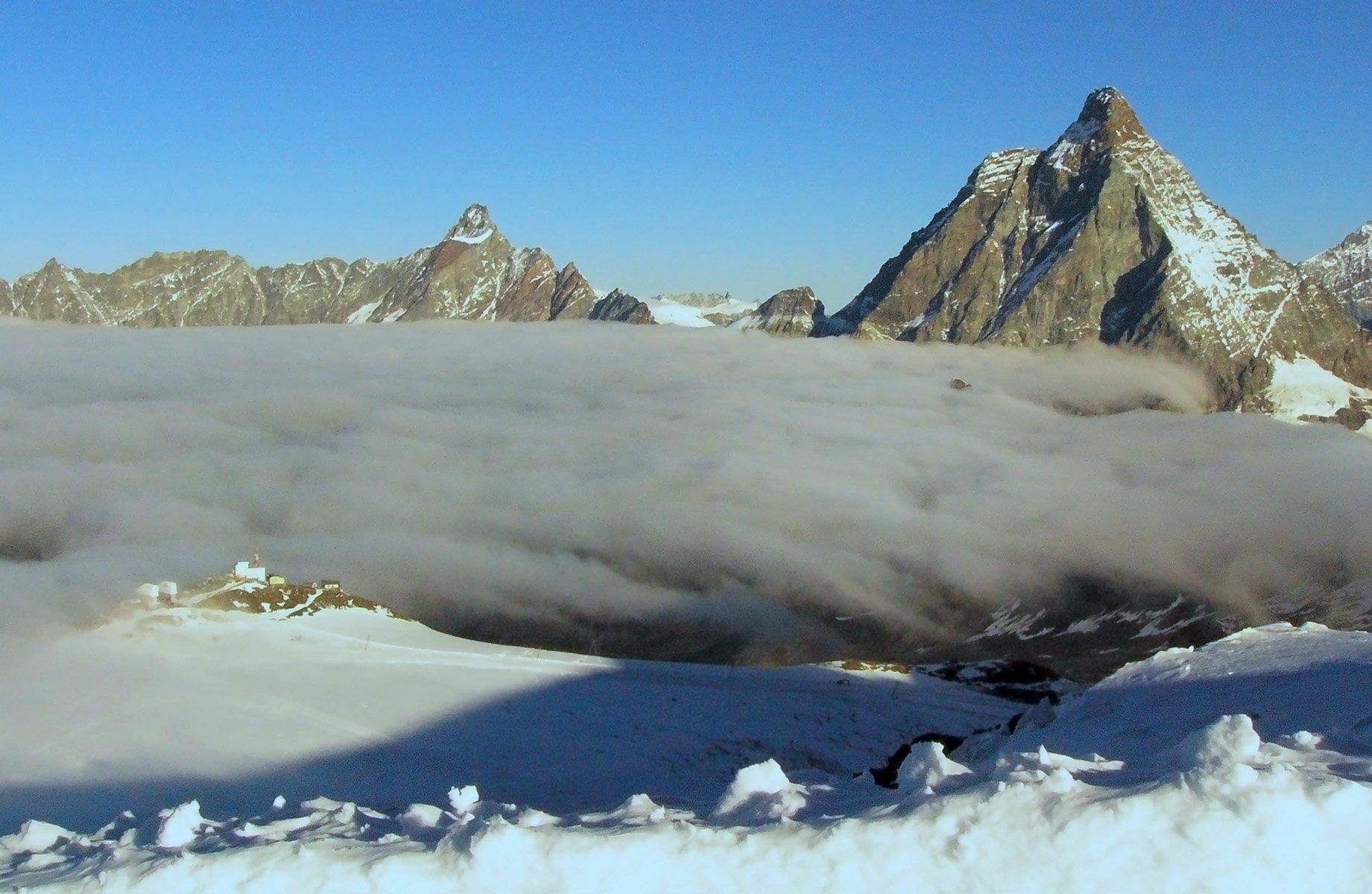
The Matterhorn
After climbing the Allalinhorn in the morning it took me a while to get back to my hotel, repack, buy a roll, and receive walking directions from my friendly hotelier. I also took the trouble of starting out in the wrong direction. So I was not on the track out of Saas Fee for Grachen until 2 pm. With a six and a half hour walk ahead of me, I was anxious to make Grachen by nightfall at 9 pm. I was obliged to take a detour because a section of the track had recently collapsed.
The walk began prettily in a forest, where I spotted a squirrel carrying a pine cone. I was sorry I had to walk fast rather than enjoying the woods at leisure. The sign-posting was good, luckily, as there were many paths branching off. Back on the main TMR route, it rained for about 20 minutes then stopped before settling down to drizzle for the last hour of my walk.
The terrain became rugged, the path clinging to the mountain. As everyone who has walked in the mountains knows, around the next corner there is always another bend. The path stayed high (around 1900m) with admirable tenacity - not being one of these annoying ones that goes down 200 metres only to go up by the same amount. Sometimes I could not tell where the path would find a way through the precipitous mountainside. At one point I discovered I was walking in the wrong direction - I had managed to turn back the way I had come. Diagnosing momentary dementia I continued on as if nothing had happened. There was no sign of human presence except for the path itself, which was well maintained. I met no-one in the last three hours or so. The highlight of this section was seeing a family of ibex on the track. They bounded down the steep mountainside with consummate ease.
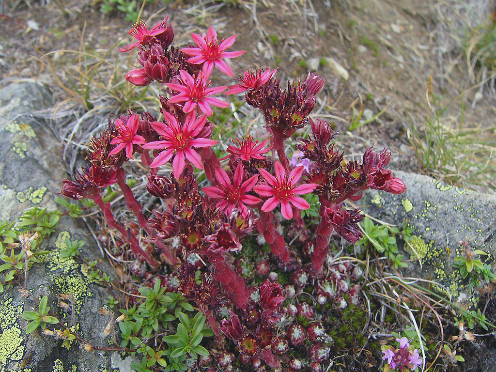
Sempervivum
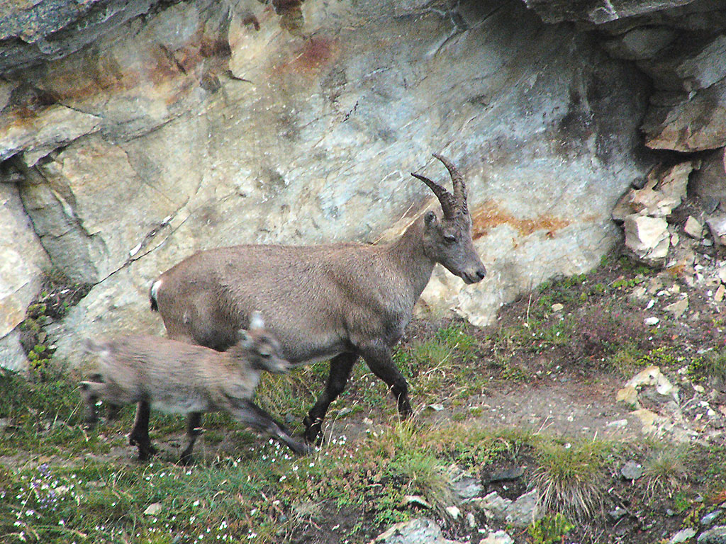
Ibex
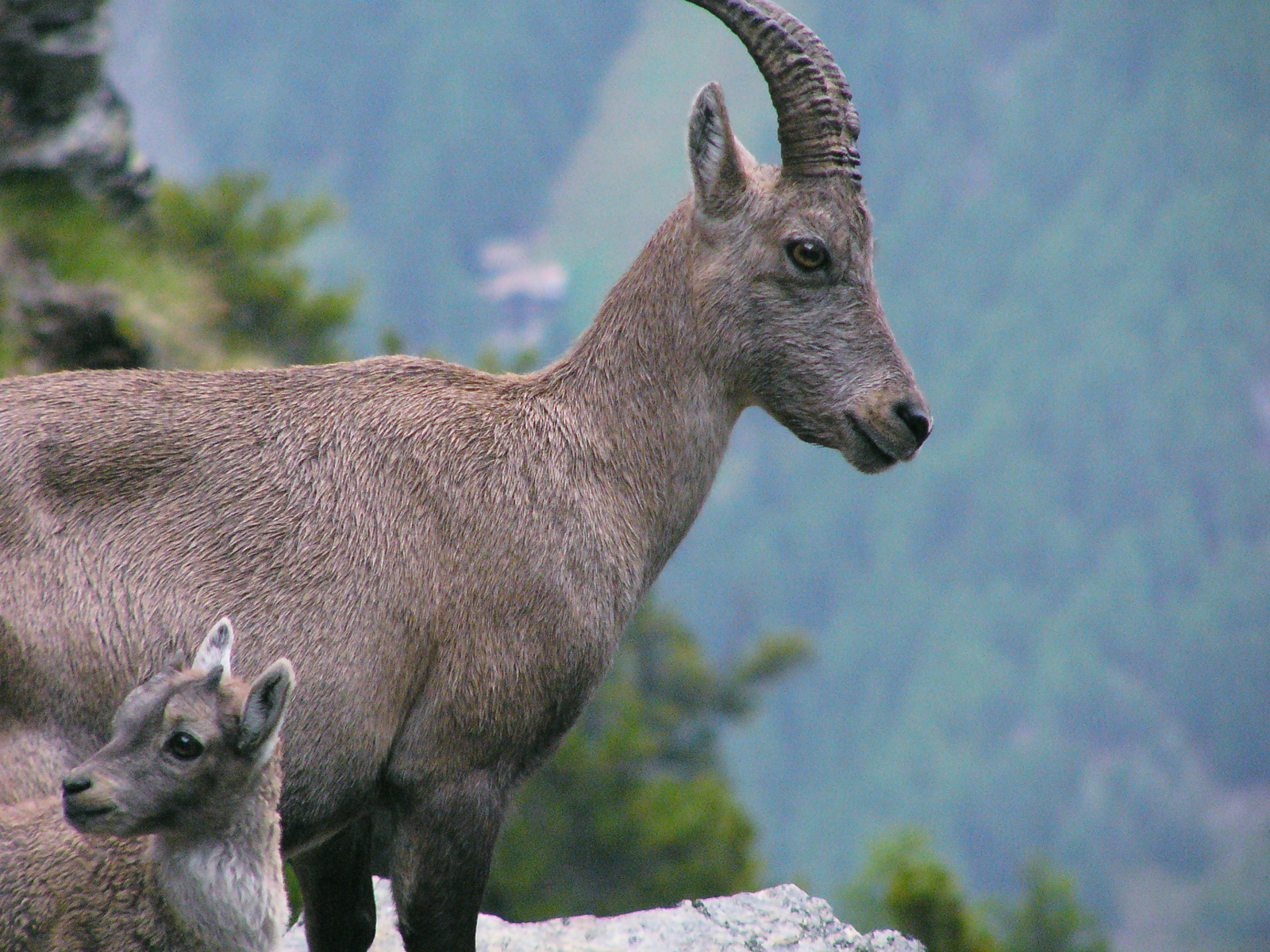
Ibex
Yet time was not on my side, since much of the TMR remained and I still wanted to have a shot at the Breithorn. The next day I decided, after much dithering, to walk down to San Niklas and to catch a train from there to Zermatt. It was a town I could not get out of fast enough. Its only plus point is that it lies close to the Matterhorn. Zermatt is so touristy it does not even have a fruit shop. I grabbed a sausage for lunch, bought a map, and was off at 12.30, with an 1859 metre climb to the Italian frontier ahead of me.
I feared getting out of Zermatt, as finding the right path out of a largish town is usually tricky. Indeed, I found that there were tracks going everywhere and that the signposting was not up to Swiss standards. I resorted to the desperate measure (for a man) of asking at every opportunity for the way to the Gandeg Hut, which was on my way. I went a little astray, but not seriously so. I felt stressed, as I knew I had a long hike ahead of me. Soon I was treated to fine views of the Matterhorn, with the mists covering and uncovering her midriff. I was short of water but made my litre last all the way to the Gandeg Hut, where I bought a half litre of delicious soda water for 5 euros (is this a record?). I drank this immediately and was off again. There is no running water at the refuge and I was too stingy to fork out another 5 euros. Soon afterwards, the snow began, so I put on my crampons rather than carrying them.
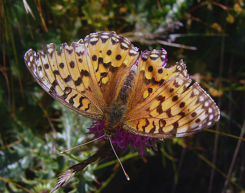
Frazzled butterfly
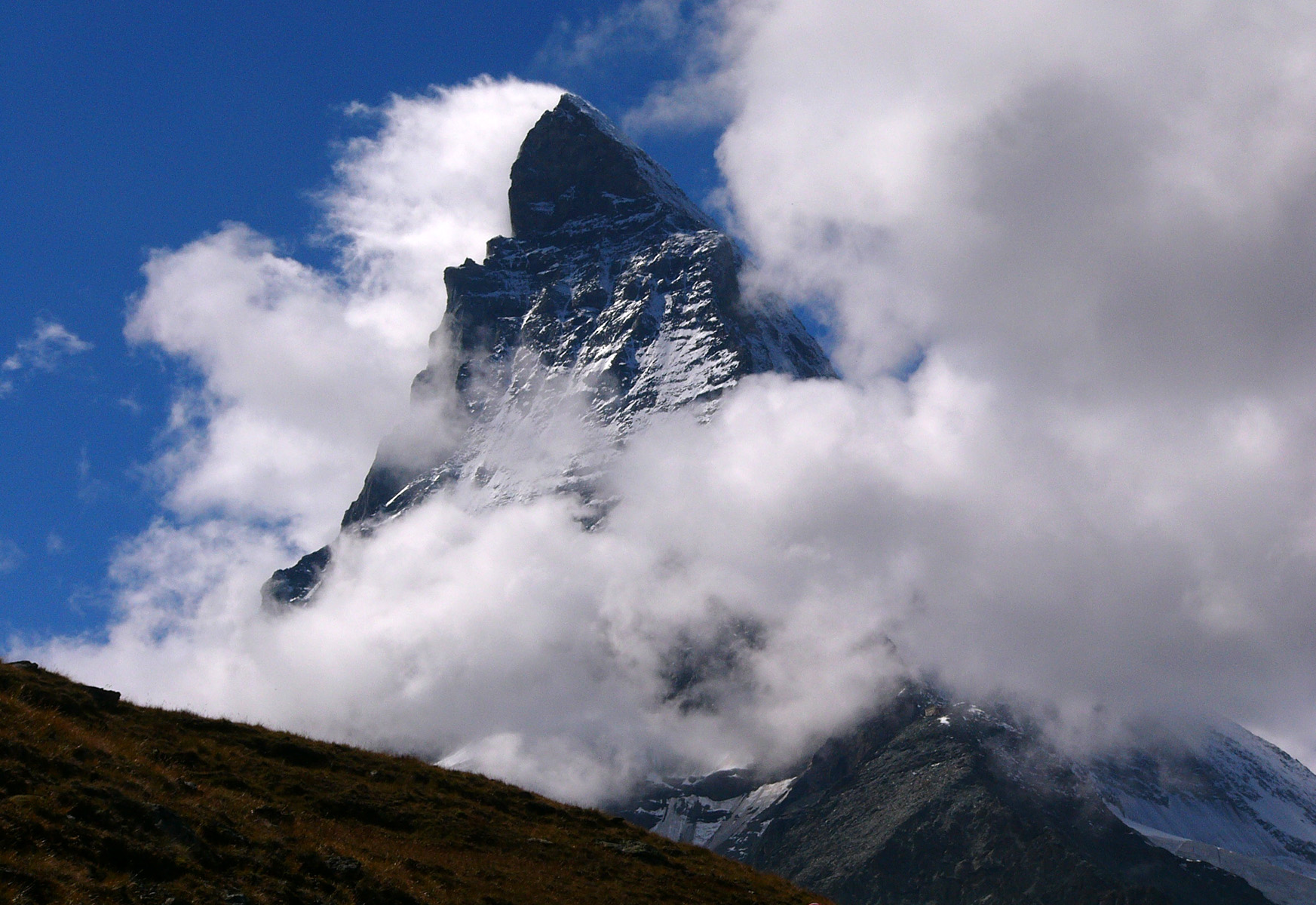
The Matterhorn
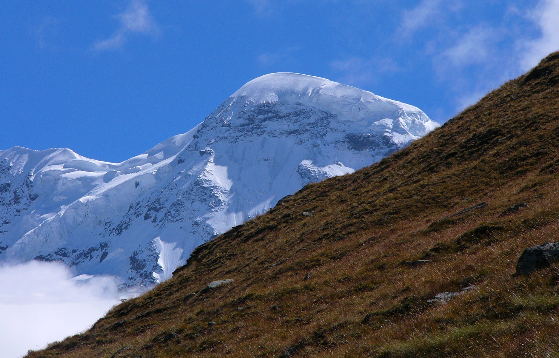
The Breithorn
At about 7 pm I received a rude shock. No refuge. There were buildings aplenty: lift buildings, a customs post, and an uninviting but open bivouac shelter (for the benefit of winter walkers), but I hoped for better. A sign informed me I was not at Passo Teodulo, which had been my aim, but at the higher Testa Grigia (3480m). The thought of sleeping at this height without food, water or bedding was not cheerful. I needed to urinate and since no-one was around I did this into the snow. Sure enough, a man immediately came out of one of the buildings. I asked him where the refuge was and he mentioned the flags down the hill. Just 50 metres away was the Rifugio dei Guide di Cervino. Boy was I relieved! When I booked myself in, the lady shouted to the kitchen to make an extra pasta, as I was the last arrival. I added "Una grande!". In fact, I received a second helping of pasta from the rotund and jovial cook. Now, being so near to the high mountains, I got a mad idea, why not climb the heavenly twins, Castor and Pollux, as well as the Breithorn, which had been my original intention? Please stay tuned.
When I got up next morning, the refuge was nearly empty. The real climbers had set out two hours earlier, but it was considerate of them to leave me their tracks to follow. It was grey and 3 degrees C when I began to walk up the ski slope at 7.30, keeping to the side, as skiers were descending apace. By the time the sun showed I was above the cable car terminus on the Kleine Matterhorn (which does not resemble the real thing except for being rocky). The ground was flat here and I saw teams of climbers heading for the Breithorn (4160m), dissipating my feeling of uncertainty and mild anxiety. Soon I began passing them.
Swiss mountains and my lodging at Testa Grigia at left
Breithorn summit
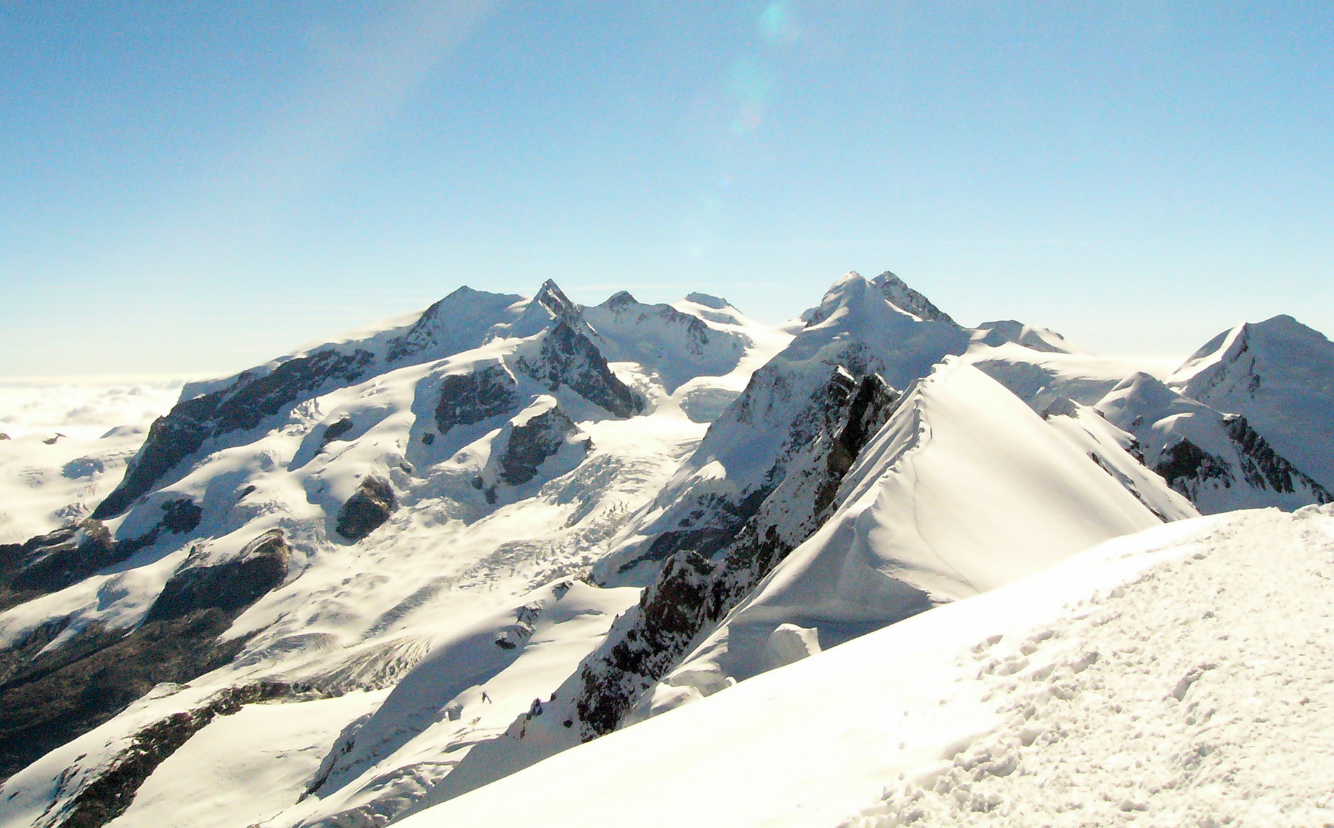
The four Monte Rosa peaks at centre left
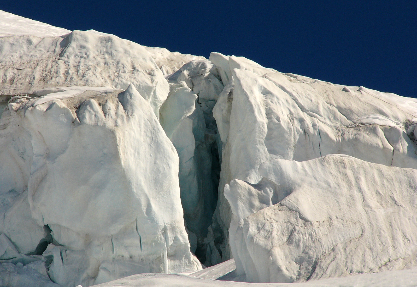
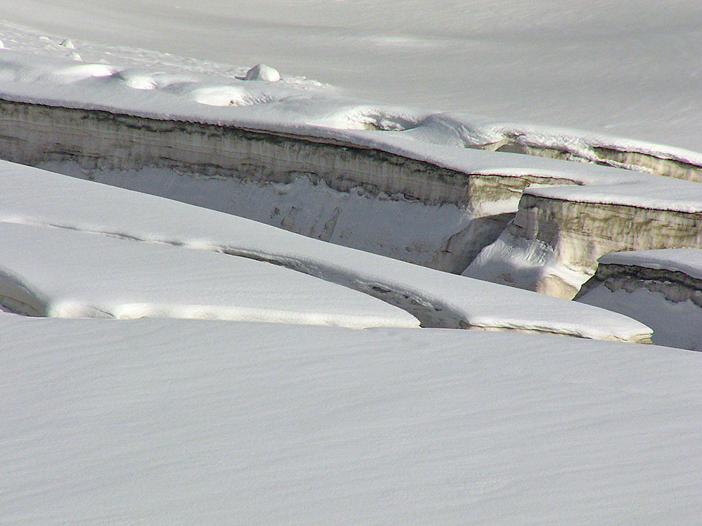
Seracs
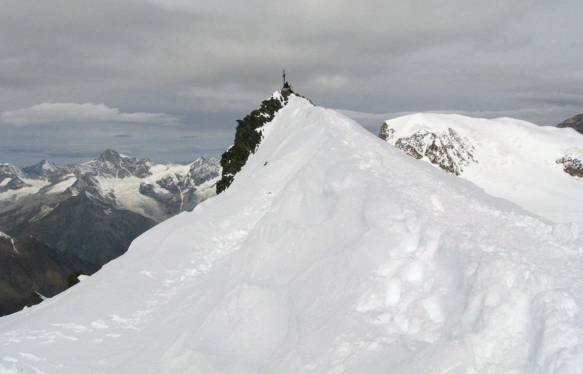
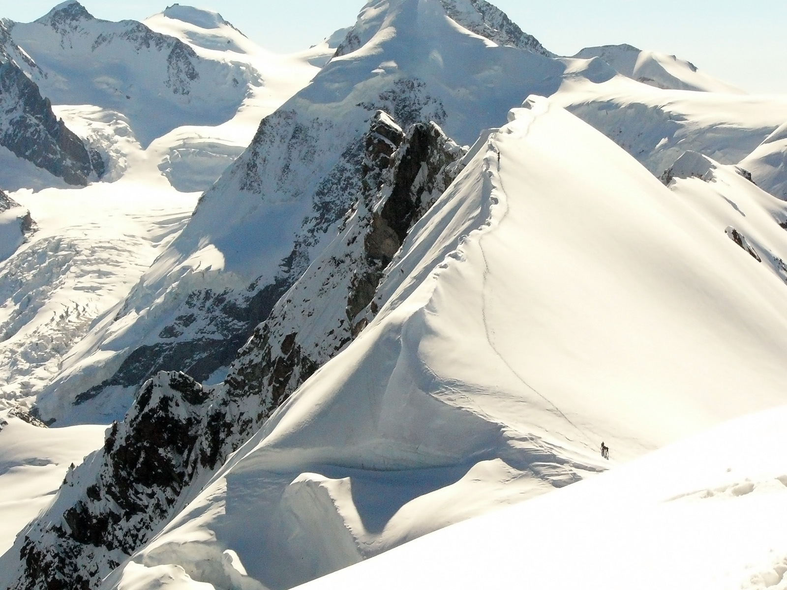
Unfortunately, my ego did not allow me to pause to savour the scenery, nor to take much care with photos, since I would have been overtaken by other climbers. I kept up a good pace and became tired as the ascent steepened. Stopping a few times to catch my breath, I soon reached what I call a "no fall zone". The slope steepened to about 45 degrees, then unexpectedly, I was on the summit ridge (shown below), which is about 50 metres long and 30 cm wide. I felt anxious walking this gauntlet, as a fall down either side could be fatal. A largish crevasse is visible on the right, though I didn't see it at the time. Now my mind was highly focused - on taking the next step without stumbling. I applied the rule, "Don't look up, don't look down. Just find a safe place to put the next step." This is truly 'being in the moment' and indeed it worked well for me. There is no time to be frightened when you are purely focused on putting down your foot. It reminds me that all forms of fear amount to living in the future rather than in the present.
Near the top of Castor
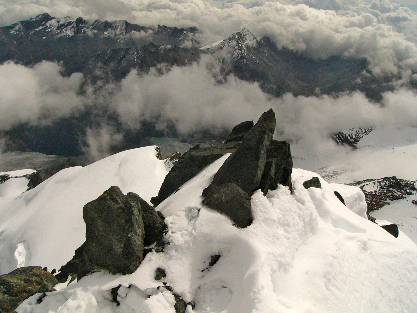
The summit ridge

Looking back down from Castor summit
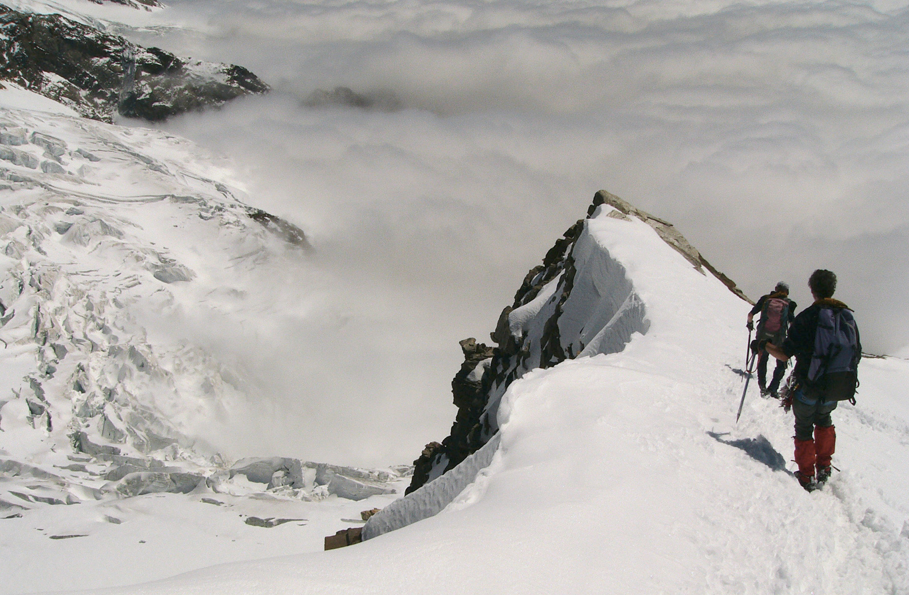
As I was considering the prospect of descending the way I had come up (not without anxiety), I met Cor and Ruud, whom Carla later dubbed my "guardian angels". These two are highly experienced but friendly Dutch climbers, to whom going up Castor was just a morning stroll. They had bigger plans. Ruud told me that my planned descent to the Ayas refuge is dangerous in the afternoon due to melting snow bridges on the crevasses. Indeed, it was so sunny that I was soon too warm walking in shirt and denim jeans. There was no wind (and the next day I woke up badly sunburnt). Ruud kindly suggested that I follow them down to the Quintino Sella Refuge, where I had planned to go the next day. One of the benefits of walking alone is that you can make quick changes of plan, so I took their advice.
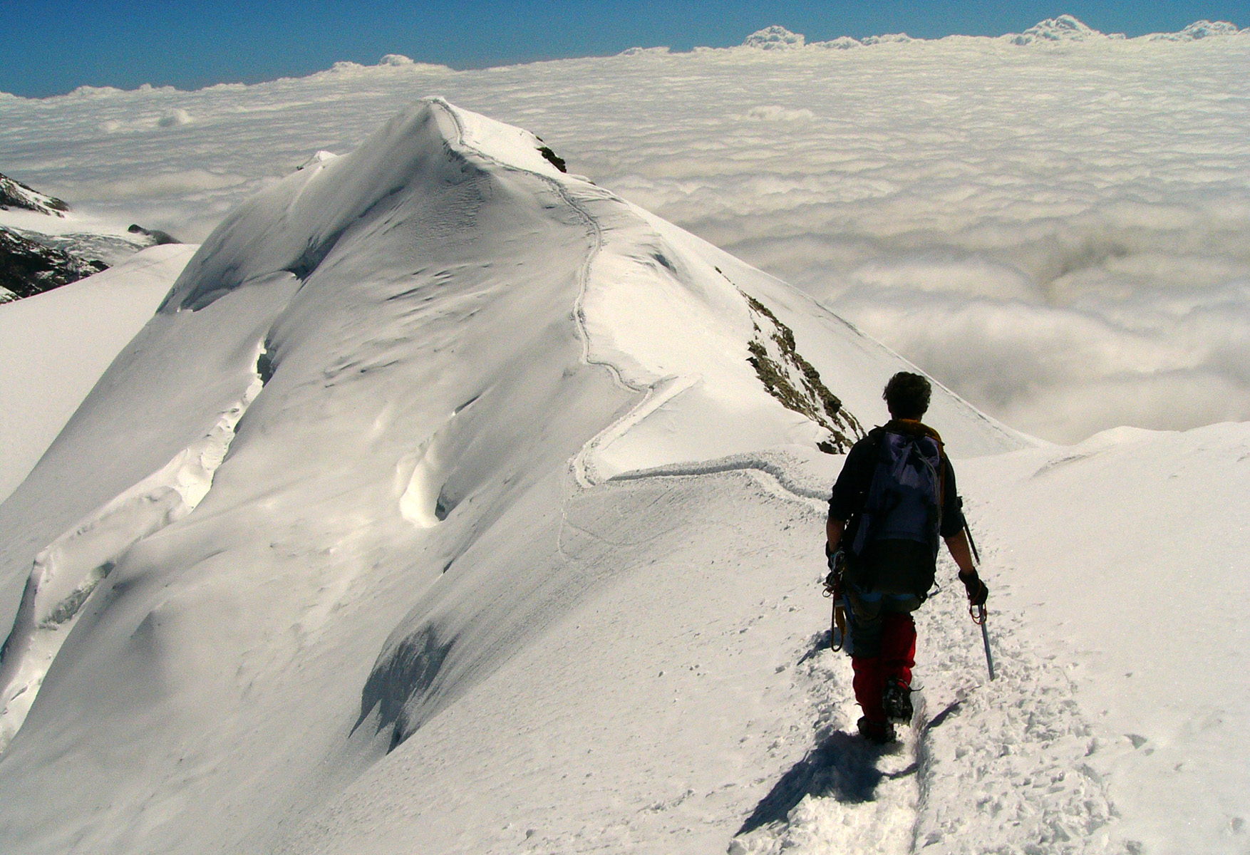
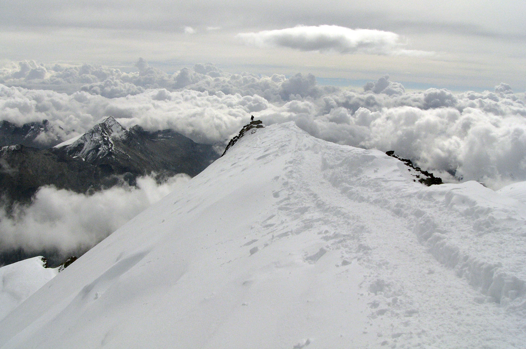
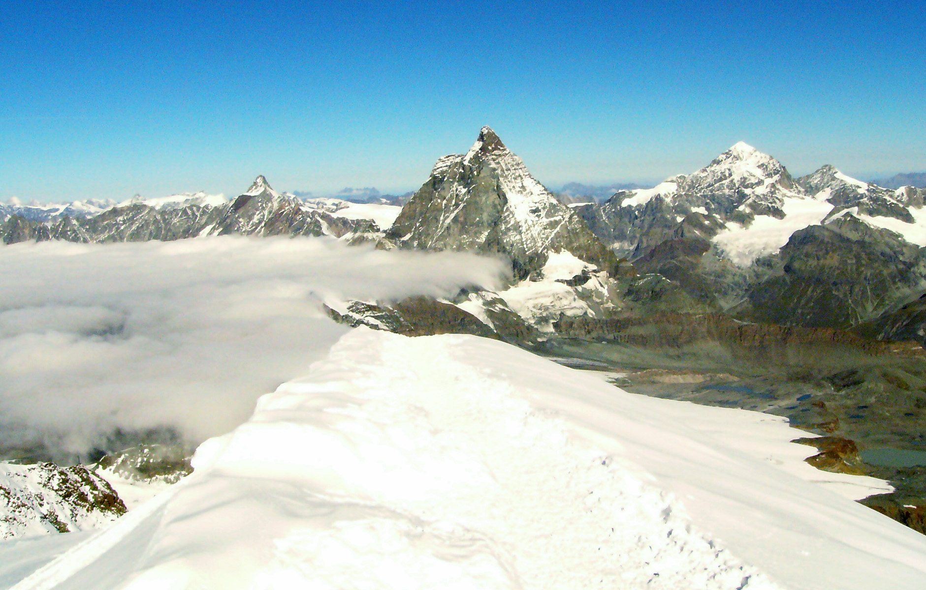
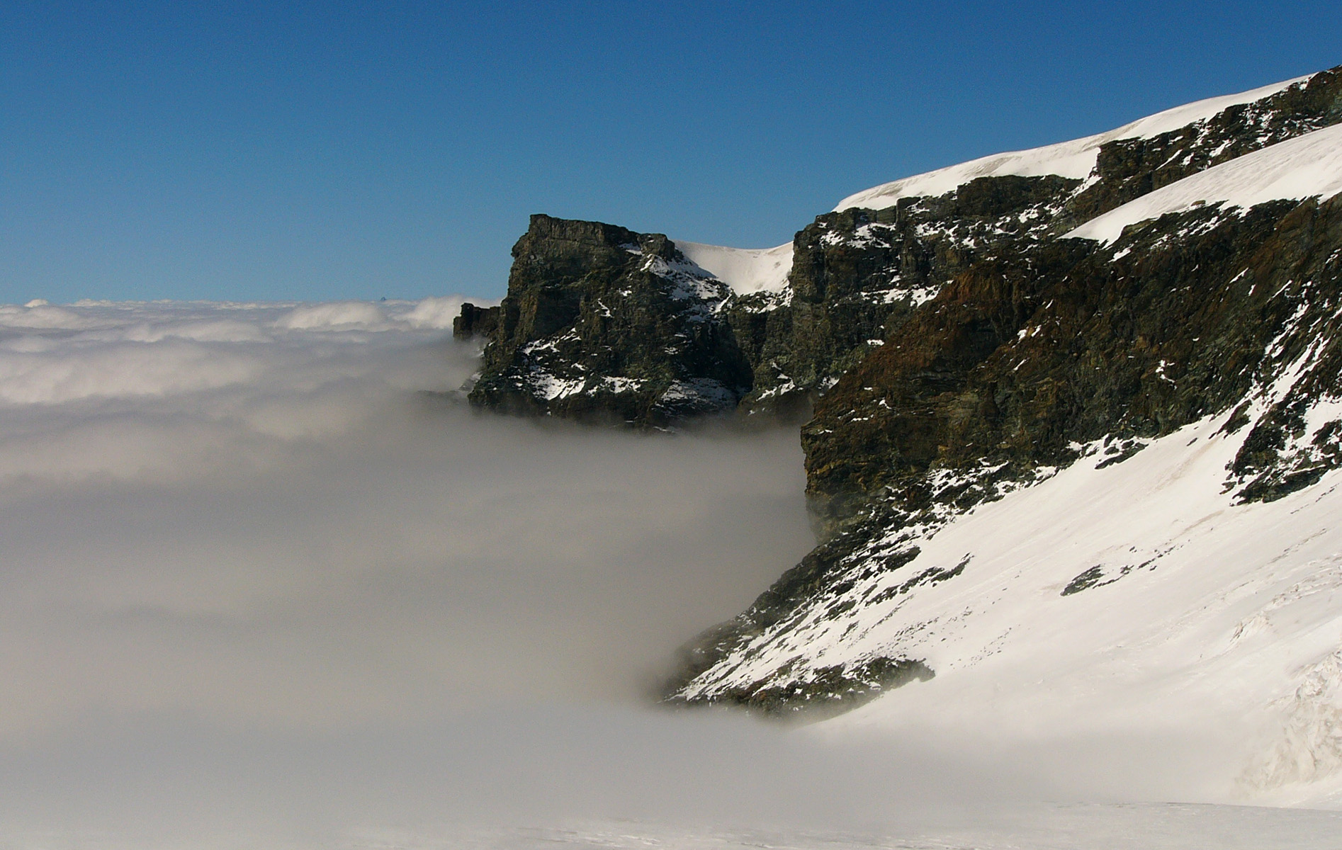
The path on the yonder side of Castor was extremely inviting, wending its way up and down crests just above the clouds.
At one point in the descent they told me to jump over a one metre wide crevasse. Had I been walking alone I would not have suspected any danger. Soon we descended into the clouds and visibility was about 30 m. At 2.30 we arrived at the Quintino Sella Refuge at 3585 m. I put my heel spur into the snow for 25 minutes and watched the little birds foraging for scraps. I nearly forgot to have lunch but managed to score a delicious ham roll from the welcoming lady at the counter. I bought us all vini caldi and asked Ruud a heap of questions about mountaineering. He told me that it is dangerous to walk alone on glaciers due to the crevasses.